Toggle navigation
LMEC Home
Exhibitions
Georeferencing
Tools for Teachers
Collections
My Favorites
Sign Up / Log In
Search
Search the map portal
Map Collection
Map Collection
Map Sets
Search
Search
Search for
Search In
All Fields
Creator
Title
Subject
Place
Search All Digital Collections
Advanced Search
63 Results
My Search
Start Over
More Like
commonwealth:4x51pm790
Remove constraint More Like: commonwealth:4x51pm790
Creator
MassGIS (Office : Mass.)
Remove constraint Creator: MassGIS (Office : Mass.)
Filter your Search
Place
North and Central America
63
United States
63
Massachusetts
62
Barnstable (county)
5
Plymouth (county)
4
Bristol (county)
3
Hampden (county)
3
Hampshire (county)
3
more
Place
»
Topic
Massachusetts--Maps
19
Land use--Massachusetts--Maps
6
Massachusetts--Photomaps--Indexes
4
Open spaces--Massachusetts--Maps
4
Watersheds--Massachusetts--Maps
4
Election districts--Massachusetts--Maps
3
Legislators--Massachusetts
3
Massachusetts--Administrative and political divisions--Election districts--Maps
3
more
Topic
»
Date
Date range begin
–
Date range end
Current results range from
1985
to
2002
1985 : 2003
1985
2003
View distribution
Creator
MassGIS (Office : Mass.)
[remove]
63
Massachusetts. Executive Office of Environmental Affairs
38
Applied Geographics, Inc.
14
Massachusetts Bays Program
7
Massachusetts. Department of Environmental Protection
4
Massachusetts. General Court. Senate. Special Committee of the Senate on Senate Redistricting
2
Beinikis, Anita I.
1
Buzzards Bay Project (Mass.)
1
more
Creator
»
Format
Maps/Atlases
63
Georeferenced
No
63
Collection
Boston and New England Maps
63
Norman B. Leventhal Map & Education Center Collection
63
Applied Geographics, Inc. Records
55
David Judkins Weaver Papers
8
Urban Maps
2
Available to use
No known restrictions
63
Search Constraints
Sort by relevance
relevance
title
date (asc)
date (desc)
Number of results to display per page
20 per page
10
per page
20
per page
50
per page
100
per page
View results as:
grid view
map view
Search Results
1.
Eastern encephalitis risk area
2.
Massachusetts areas of critical environmental concern
3.
Properties of the Trustees of Reservations and other protected open space
4.
Massachusetts open space and recreation facilities
5.
EOEA wide area network
6.
Executive Office of Environmental Affairs location of offices
7.
Massachusetts coastal watersheds
8.
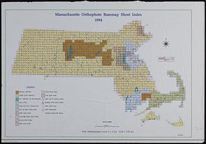
Massachusetts orthophoto basemap sheet index
9.
Massachusetts orthophoto basemap sheet index
10.
Orthophoto index
11.
Orthophoto quads index
12.
DEM protected open space
13.
Wellhead protection areas in southeastern Massachusetts
14.
Wellhead protection areas in southeastern Massachusetts
15.
EOEA MassGIS geographic information system transition document : The EOEA geographic information system: MassGIS
16.
Massachusetts drainage basins
17.
Massachusetts land use - 1985
18.
Massachusetts land use - 1985
19.
Metacomet-Monadnock Trail : an analysis of landuse
20.
1985 land use in the Mass. Turnpike corridor
‹ Prev
Next ›
1
2
3
4