Toggle navigation
LMEC Home
Exhibitions
Georeferencing
Tools for Teachers
Collections
My Favorites
Sign Up / Log In
Search
Search the map portal
Map Collection
Map Collection
Map Sets
Search
Search
Search for
Search In
All Fields
Creator
Title
Subject
Place
Search All Digital Collections
Advanced Search
29 Results
My Search
Start Over
More Like
commonwealth-oai:g158gg641
Remove constraint More Like: commonwealth-oai:g158gg641
Creator
Jefferys, Thomas, -1771
Remove constraint Creator: Jefferys, Thomas, -1771
Filter your Search
Place
North and Central America
26
Canada
15
Quebec
14
Saint Lawrence River
13
Longue-Pointe-de-Mingan
12
Mingan Îles de
12
Saguenay
12
Sept Iles
12
more
Place
»
Topic
Saint Lawrence River--Maps
13
United States--History--French and Indian War, 1754-1763--Maps
13
Longue-Pointe (Québec)--Maps
12
Mingan Islands (Québec)--Maps
12
Saguenay River (Québec)--Maps
12
Sept-Iles (Québec)--Maps
12
Braddock's Campaign, 1755--Maps
10
Tactics--Maps--Early works to 1800
4
more
Topic
»
Date
Date range begin
–
Date range end
Current results range from
1750
to
1775
1750 : 1776
1750
1776
1750
1752
1754
1756
1758
1760
1762
1764
1766
1768
1770
1772
1774
1776
Creator
Jefferys, Thomas, -1771
[remove]
29
Cook, James, 1728-1779
12
Desjardins, pilot of Québec
12
Robert Sayer and John Bennett (Firm)
12
Saunders, Charles, Sir, 1713?-1775
12
Orme, Robert, -1781
10
Sayer, Robert, 1725-1794
5
Stobo, Robert, 1726-1770
1
Format
Maps/Atlases
29
Georeferenced
No
29
Collection
American Revolutionary War-Era Maps
29
William L. Clements Library Collection
24
Richard H. Brown Revolutionary War Map Collection at Mount Vernon
3
MacLean Collection Map Library
1
Norman B. Leventhal Map & Education Center Collection
1
Available to use
Creative Commons license
3
No known restrictions
1
Search Constraints
Sort by relevance
relevance
title
date (asc)
date (desc)
Number of results to display per page
20 per page
10
per page
20
per page
50
per page
100
per page
View results as:
grid view
map view
Search Results
1.
A correct plan of the environs of Quebec, and of the battle fought on the 13th September, 1759 : together with a particular...
2.
A map of the country between Will's Creek & Monongahela River shewing the rout and encampments of the English army, in 1755
3.
Plan of Fort le Quesne, built by the French at the fort of the Ohio and monongahela in 1754
4.
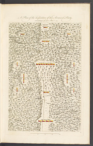
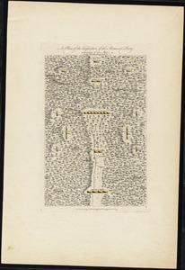
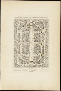
A plan of the disposition of the advanced party, consisting of 400 men
5.
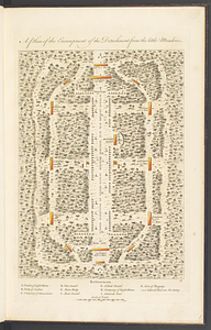
A plan of the encampment of the detachment from the Little Meadows
6.
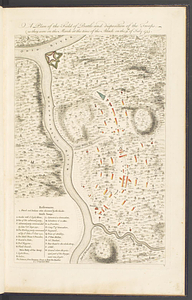
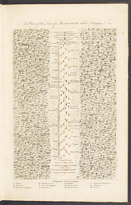
A plan of the field of battle and disposition of the troops, as they were on the march at the time of the attack on the 9th of...
7.
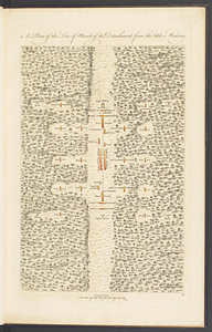
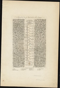
A plan of the line of march of the detachment from the Little Meadows
8.
A plan of the line of march with the whole baggage
9.
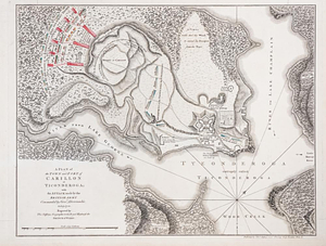
A plan of the town and fort of Carillon at Ticonderoga : with the attack made by the British army commanded by Genl....
10.
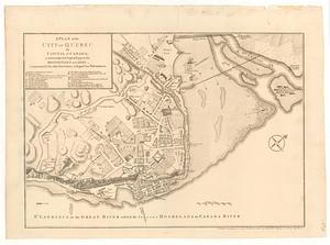
A plan of the city of Quebec the capital of Canada : as it surrender'd 18 Septemb.r 1759 to the British fleet and army ;...
11.
A plan of the disposition of the advanced party consisting of 400 men : to defend the workers in making the road
12.
A plan of the encampment of the detachment from the little Meadows
13.
A plan of the line of march of the detachment from the little Meadows
14.
A plan of the line of march with the whole baggage
15.
Channels around the Island of Orleans
16.
Gaspee Bay
17.
Hare Island; Pointe aux Allouettes of Larks Point; English Bank
18.
Manicouagan Shoals; Havre St. Nicholas; Bay of the Seven Islands
19.
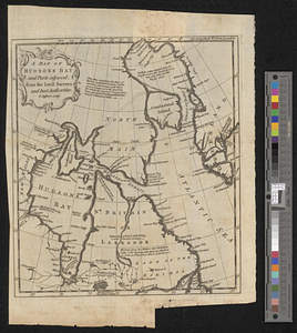
A map of Hudsons Bay and parts adjacent from the latest surveys and best authorities
20.
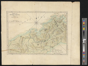
A map of the isthmus of Panama drawn from Spanish surveys
+
-
Redo search here
Search when I move the map
Leaflet
| ©
OpenStreetMap
contributors, ©
CartoDB
‹ Prev
Next ›
1
2