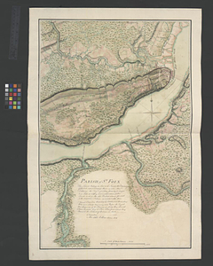
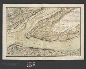
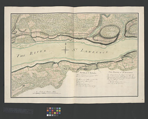
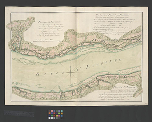
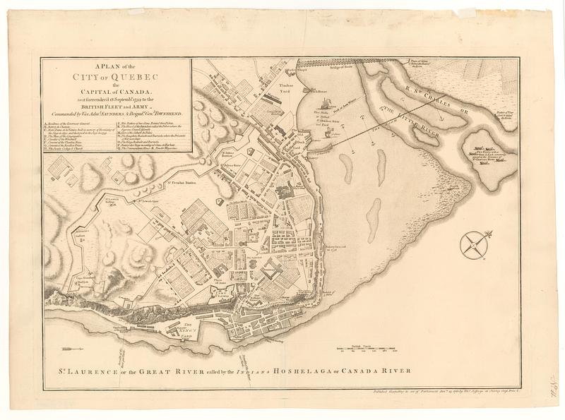
A plan of the city of Quebec the capital of Canada : as it surrender'd 18 Septemb.r 1759 to the British fleet and army ; commanded by Vice Adm.l Saunders & Brigad.r Gen.l Townshend
This map is also available in American Revolutionary Geographies Online (ARGO), a collections portal especially built for material relating to the American Revolutionary War Era. Visit ARGO to learn more about this item and explore the historical geography of North America in the late eighteenth century.
Item Information
- Title:
- A plan of the city of Quebec the capital of Canada : as it surrender'd 18 Septemb.r 1759 to the British fleet and army ; commanded by Vice Adm.l Saunders & Brigad.r Gen.l Townshend
- Publisher:
- Jefferys, Thomas, -1771
- Date:
-
[1768]
- Format:
-
Maps/Atlases
- Location:
- MacLean Collection Map Library
- Collection (local):
-
MacLean Collection Map Library
- Subjects:
-
Québec Campaign, Québec, 1759--Maps
Saint Lawrence River--Maps
- Places:
-
Saint Lawrence River
CanadaQuebec (province)Québec
- Extent:
- 1 map ; 336 x 484 mm
- Terms of Use:
-
Public Domain/No known restrictions on use. Contact host institution to download image.
Contact host institution for more information.
- Publisher:
-
London :
Tho.s Jefferys at Charing Cross
- Language:
-
English
- Notes (date):
-
This date is inferred.
- Identifier:
-
MC_4357
- Call #:
-
4357