Toggle navigation
LMEC Home
Exhibitions
Georeferencing
Tools for Teachers
Collections
My Favorites
Sign Up / Log In
Search
Search the map portal
Map Collection
Map Collection
Map Sets
Search
Search
Search for
Search In
All Fields
Creator
Title
Subject
Place
Search All Digital Collections
Advanced Search
7827 Results
My Search
Start Over
More Like
commonwealth:kk91fr08t
Remove constraint More Like: commonwealth:kk91fr08t
Georeferenced
No
Remove constraint Georeferenced: No
Filter your Search
Place
North and Central America
5,229
United States
4,208
Massachusetts
1,832
Europe
1,316
Suffolk (county)
923
Boston
903
Canada
438
Asia
400
more
Place
»
Topic
Boston (Mass.)--Maps
506
United States--Maps
219
Real property--Massachusetts--Boston--Maps
168
Landowners--Massachusetts--Boston--Maps
128
Massachusetts--Maps
107
North America--Maps--Early works to 1800
102
New England--Maps
85
World maps
71
more
Topic
»
Date
Date range begin
–
Date range end
Current results range from
1482
to
2023
1482 : 2024
1482
2024
View distribution
Creator
United States. Hydrographic Office
594
O.H. Bailey & Co
148
Des Barres, Joseph F. W. (Joseph Frederick Wallet), 1722-1824
119
Ptolemy, 2nd cent
100
Walling, Henry Francis, 1825-1888
86
Jefferys, Thomas, -1771
84
Jansson, Jan, 1588-1664
75
Geological Survey (U.S.)
71
more
Creator
»
Format
Maps/Atlases
7,767
Manuscripts
201
Prints
56
Books
36
Objects/Artifacts
10
Drawings/Illustrations
8
Posters
5
Georeferenced
No
[remove]
7,827
Collection
Norman B. Leventhal Map & Education Center Collection
7,825
Boston and New England Maps
2,024
Urban Maps
1,852
Maritime Charts and Atlases
1,073
American Revolutionary War-Era Maps
582
Boston Redevelopment Authority Collection
87
MacLean Collection Map Library
1
Richard H. Brown Revolutionary War Map Collection at Mount Vernon
1
Available to use
No known restrictions
7,716
Creative Commons license
41
Search Constraints
Sort by relevance
relevance
title
date (asc)
date (desc)
Number of results to display per page
20 per page
10
per page
20
per page
50
per page
100
per page
View results as:
grid view
map view
Search Results
1.
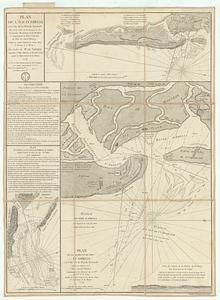
Plan de l'ile d'Amelia a la cote de la Floride orientale
2.
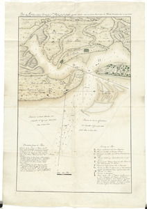
Plan du Havre et de la barre de Ste. Marie par les Angloises appellée Amélia, ainsi que de la Barre dans la Floride orientale
3.
The 100th anniversary map of Abraham Lincoln's visit to Massachusetts, September 11-23, 1848
4.
19th annual convention of the National Association of Real Estate Boards : at Tulsa, June 7 to June 11 in 1926
5.
2005 significant U.S. hurricane strikes
6.
The 2100 project : an atlas for the Green New Deal
7.
227 Harzgerode
8.
305 Glatz
9.
38,000,000 escaped -- 10,000,000 died
10.
660 Wakulah St., Roxbury
11.
74 miles on the ocean scenic highway U.S. 1
12.
Aaron Bohrod's America, its history
13.
Aboriginal map of North America, denoting the boundaries and the locations of various Indian tribes
14.
Acapulco, México
15.
Accurata delineatio Castrorum Suecicorum, ut et Haffniae, Regni Daniae Metropolis
16.
Accurata delineatio oppugnatae a faederatis, Caesareis, Polonicis, Danicis, et Brandeburgicis copijs sub-ductu Seren: Electoris...
17.
Accurata delineatio regionis circa Nieburgum Fioniæ cum prælio ibi commisso inter Danorum et fæderatorum exercitum ab una et...
18.
Accurata Scaniae, Blekingiae et Hallandiae descriptio
19.
An accurate map of Dorset Shire, divided into its hundreds
20.
An accurate map of England and Wales with the principal roads from the best authorities
‹ Prev
Next ›
1
2
3
4
5
…
391
392