Toggle navigation
LMEC Home
Exhibitions
Georeferencing
Tools for Teachers
Collections
My Favorites
Sign Up / Log In
Search
Search the map portal
Map Collection
Map Collection
Map Sets
Search
Search
Search for
Search In
All Fields
Creator
Title
Subject
Place
Search All Digital Collections
Advanced Search
197 Results
My Search
Start Over
More Like
commonwealth:pc28d1639
Remove constraint More Like: commonwealth:pc28d1639
Collection
Boston Redevelopment Authority Collection
Remove constraint Collection: Boston Redevelopment Authority Collection
Filter your Search
Place
Boston
197
North and Central America
197
Suffolk (county)
197
United States
197
Massachusetts
93
Downtown Boston
36
South End
13
Downtown Crossing
11
more
Place
»
Topic
City planning--Massachusetts--Boston--Maps
147
Boston (Mass.)--Maps
120
Urban renewal--Massachusetts--Boston--Maps
82
Land use--Massachusetts--Boston--Maps
34
Central business districts--Massachusetts--Boston--Maps
33
Buildings--Massachusetts--Boston--Maps
31
Real property--Massachusetts--Boston--Maps
19
Waterfronts--Massachusetts--Boston--Maps
16
more
Topic
»
Date
Date range begin
–
Date range end
Current results range from
1893
to
1999
1893 : 2000
1893
2000
1900
1910
1920
1930
1940
1950
1960
1970
1980
1990
2000
Creator
Boston Redevelopment Authority
149
Downtown Waterfront Corporation
10
Victor Gruen Associates
10
Boston (Mass.). Parks and Recreation Department
5
Pressley Associates
5
Massachusetts. Department of Environmental Management
4
Olmsted Historic Landscape Preservation Program (Mass.)
4
Walmsley & Company
4
more
Creator
»
Format
Maps/Atlases
193
Drawings/Illustrations
7
Georeferenced
No
197
Collection
Boston Redevelopment Authority Collection
[remove]
197
Boston and New England Maps
197
Urban Maps
197
Norman B. Leventhal Map & Education Center Collection
88
Available to use
No known restrictions
197
Search Constraints
Sort by relevance
relevance
title
date (asc)
date (desc)
Number of results to display per page
20 per page
10
per page
20
per page
50
per page
100
per page
View results as:
grid view
map view
Search Results
1.
Parker Hill-Fenway project no. Mass. R-48 : police signal system, fire alarm system and M.T.A. facilities
2.
Fenway urban renewal area : major thoroughfares
3.
Back Bay project no. Mass. R-47 : police signal system, fire alarm system and M.T.A. facilities
4.
Government Center project no. Mass. r-35 : proposed land use map
5.
Government Center project no. Mass. r-35 : subway adjustments plan
6.
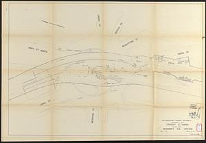
Tremont St. subway Boston, Mass. Haymarket Sq. Station
7.
Boston urban wilds : geology
8.
Boston urban wilds : ownership
9.
Boston urban wilds inventory
10.
Building #33, Charlestown Navy Yard flr. plans
11.
Campus High School urban renewal area Mass. r-129 : property map
12.
Central business district urban renewal area project no. Mass. R-82L site preparation contract T : planting plan and details
13.
City of Boston
14.
City of Boston topographic and planimetric survey : [Downtown and North End]
15.
Historical map of the Emerald Necklace
16.
Major thoroughfare system, city of Boston, July 1979
17.
Outline map of Boston
18.
Plan of the parkway between Muddy River gate house and Jamaica Park 1892
19.
Rose F. Kennedy Garden
20.
Rose Kennedy Garden : contract documents August 1986 : prepared for City of Boston ; Parks & Recreations Department ; Boston...
+
-
Redo search here
Search when I move the map
Leaflet
| ©
OpenStreetMap
contributors, ©
CartoDB
‹ Prev
Next ›
1
2
3
4
5
…
9
10