Toggle navigation
LMEC Home
Exhibitions
Georeferencing
Tools for Teachers
Collections
My Favorites
Sign Up / Log In
Search
Search the map portal
Map Collection
Map Collection
Map Sets
Search
Search
Search for
Search In
All Fields
Creator
Title
Subject
Place
Search All Digital Collections
Advanced Search
13676 Results
Filter your Search
Place
North and Central America
10,342
United States
8,473
Massachusetts
2,788
Suffolk (county)
1,677
Boston
1,633
Europe
1,413
Canada
950
New York
649
more
Place
»
Topic
Boston (Mass.)--Maps
747
City planning--Massachusetts--Boston--Maps
418
United States--History--Revolution, 1775-1783--Maps
329
United States--Maps
322
Real property--Massachusetts--Boston--Maps
254
Urban renewal--Massachusetts--Boston--Maps
254
Massachusetts--Maps
231
Insurance surveys
197
more
Topic
»
Date
Date range begin
–
Date range end
Current results range from
1482
to
2023
View distribution
Creator
United States. Hydrographic Office
597
Boston Redevelopment Authority
404
Des Barres, Joseph F. W. (Joseph Frederick Wallet), 1722-1824
247
Royal United Services Institute for Defence and Security Studies
160
Jefferys, Thomas, -1771
154
George, III, King of Great Britain, 1738-1820
152
George, IV, King of Great Britain, 1762-1830
151
O.H. Bailey & Co
148
more
Creator
»
Format
Maps/Atlases
13,495
Manuscripts
985
Prints
102
Books
49
Drawings/Illustrations
44
Photographs
15
Objects/Artifacts
13
Documents
7
more
Format
»
Georeferenced
Yes
979
No
12,697
Collection
Norman B. Leventhal Map & Education Center Collection
9,093
American Revolutionary War-Era Maps
3,305
Boston and New England Maps
2,914
Urban Maps
2,469
Maritime Charts and Atlases
1,169
William L. Clements Library Collection
910
Library of Congress Collection
618
Boston Redevelopment Authority Collection
475
more
Collection
»
Available to use
No known restrictions
10,242
Creative Commons license
1,678
Search Constraints
Sort by relevance
relevance
title
date (asc)
date (desc)
Number of results to display per page
20 per page
10
per page
20
per page
50
per page
100
per page
View results as:
grid view
map view
Search Results
5021.
Map of Boston inner harbor
5022.
Map of Boston inner harbor to accompany report under chapter 93, resolves of 1907, December 1, 1907
5023.
Map of Boston naval shipyard, Boston, Mass. showing conditions on Jan. 1, 1966
5024.
Map of Boston postal stations
5025.
Map of Boston proper
5026.
Map of Boston proper, Charlestown, South Boston and East Boston : showing original territory of old Boston, the areas filled...
5027.
Map of Boston proper, showing proposed railroad tunnels and business streets
5028.
Map of Boston showing location of the Lenox
5029.
Map of Boston showing new division of wards
5030.
Map of Boston showing proposed new division of wards Oct. 1875
5031.
[Map of Boston, showing surface lines, proposed elevated lines, connecting surface lines and route of subway
5032.
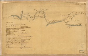
[Map of Boston, showing the new wards]
5033.
Map of Boyd, Carter and Greenup Counties
5034.
Map of Bretton Woods and surroundings
5035.
Map of Bristol County Massachusetts : based on the trigonometrical survey of the state
5036.
Map of Bristol County, Rhode Island
5037.
Map of British Columbia and part of western Canada, showing the lines and lands of the Canadian Pacific Railway
5038.
Map of British Columbia to the 56th parallel, north latitude
5039.
Map of British outposts between Burlington and New Bridge, New Jersey, December 1776
5040.
Map of Brookline and vicinity
‹ Prev
Next ›
1
2
…
248
249
250
251
252
253
254
255
256
…
683
684


![[Map of Boston, showing the new wards]](https://bpldcassets.blob.core.windows.net/derivatives/images/commonwealth:9s161h691/image_thumbnail_300.jpg)