Toggle navigation
LMEC Home
Exhibitions
Georeferencing
Tools for Teachers
Collections
My Favorites
Sign Up / Log In
Search
Search the map portal
Map Collection
Map Collection
Map Sets
Search
Search
Search for
Search In
All Fields
Creator
Title
Subject
Place
Search All Digital Collections
Advanced Search
2843 Results
My Search
Start Over
atlas
Remove constraint atlas
Filter your Search
Place
North and Central America
1,647
United States
987
Europe
464
Massachusetts
348
Canada
271
Asia
190
South America
189
Suffolk (county)
163
more
Place
»
Topic
Landowners--Massachusetts--Boston--Maps
115
Real property--Massachusetts--Boston--Maps
106
United States--Maps
87
Boston (Mass.)--Maps
63
United States--History--French and Indian War, 1754-1763--Maps
63
Saint Lawrence River--Maps
41
Nautical charts--Early works to 1800
39
North America--Maps--Early works to 1800
36
more
Topic
»
Date
Date range begin
–
Date range end
Current results range from
1482
to
2023
View distribution
Creator
United States. Hydrographic Office
582
Des Barres, Joseph F. W. (Joseph Frederick Wallet), 1722-1824
118
Ptolemy, 2nd cent
100
Bromley, George Washington
99
Bromley, Walter Scott
97
G.W. Bromley & Co.
75
Carey, Mathew, 1760-1839
74
Paullin, Charles Oscar, 1868 or 1869-1944
70
more
Creator
»
Format
Maps/Atlases
2,827
Manuscripts
58
Books
37
Prints
8
Documents
5
Drawings/Illustrations
1
Georeferenced
Yes
142
No
2,701
Collection
Norman B. Leventhal Map & Education Center Collection
2,386
Maritime Charts and Atlases
1,150
American Revolutionary War-Era Maps
504
Boston and New England Maps
374
Urban Maps
250
Massachusetts Real Estate Atlases
144
William L. Clements Library Collection
92
Mapping Boston Collection
61
more
Collection
»
Available to use
No known restrictions
2,292
Creative Commons license
158
Search Constraints
Sort by relevance
relevance
title
date (asc)
date (desc)
Number of results to display per page
20 per page
10
per page
20
per page
50
per page
100
per page
View results as:
grid view
map view
Search Results
1341.
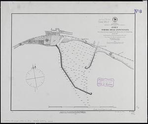
Mediterranean, south west coast of Italy, Gulf of Naples, Port Torre dell'Annunziata
1342.
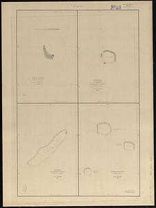
Metia Island, Paumotu Group ; Taweree or St. Simeon or Resolution Island, Paumotu Group ; Takurea or Wolconsky Island, Paumotu...
1343.
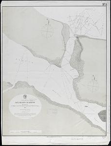
Mexico, Gulf coast, Alvarado Harbor : surveyed by the officers of the U.S.S. "Fortune" Lieut. Comdr. F.M. Green, comdg.
1344.
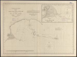
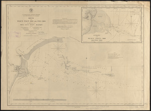
Mouth of the Teen-tsin-ho or Pei-ho and approach to the Sha-lui-tien banks
1345.
Mouth of the Teen-tsin-ho or Pei-ho and approach to the Sha-lui-tien banks
1346.
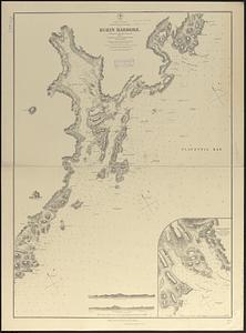
N. America--east coast, Newfoundland--south coast, Burin Harbors
1347.
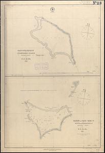
Nanouti, Bishop or Sydenhams Island, Kingsmill Group ; Makin and Tari Tari Is. or Pitts and Touching Is., Kingsmill Group
1348.
A new and accurate chart of the Bay of Chesapeak including Delaware Bay with all the shoals, channels, islands, entrances,...
1349.
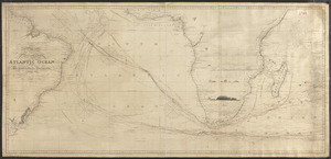
A new and correct chart of the Atlantic Ocean
1350.
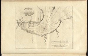
A new and correct draught of the bay of Matanzas : on ye north side of ye island of Cuba ; done from a survey in the year 1729...
1351.
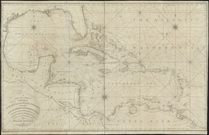
A new and correct general chart of the West Indies including the Gulf of Mexico & Bay of Honduras &c : collected from the...
1352.
A new chart of the Bahama Islands and the Windward Passage
1353.
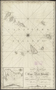
A new chart of the Cape Verd Islands, from the latest authorities
1354.
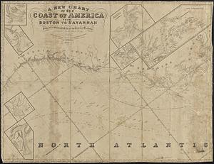
A new chart of the coast of America from Boston to Savannah with plans on an enlarged scale, of the principal harbours :...
1355.
A new chart of the Gulf of Florida and Bahama Banks also the Bahama Islands taken from a new chart published in Cadiz from a...
1356.
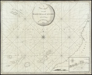
A New Chart of the Madeira and Canary Islands
1357.
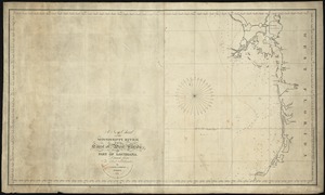
A new chart of the Mississippi River, the coast of west Florida, and part of Louisiana
1358.
A new general chart of the West Indies from the latest marine journals and surveys regulated and ascertained by astronomical...
1359.
A new generall chart for the West Indies of E. Wrights projection vul. Mercators chart
1360.
A new mapp of Carolina
‹ Prev
Next ›
1
2
…
64
65
66
67
68
69
70
71
72
…
142
143