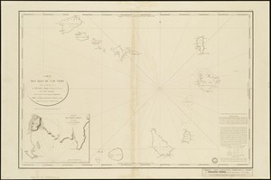
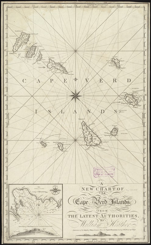
A new chart of the Cape Verd Islands, from the latest authorities
Item Information
- Title:
- A new chart of the Cape Verd Islands, from the latest authorities
- Creator:
- Heather, William, 1764-1812
- Name on Item:
-
by William Heather ; Stevenson engraver.
- Date:
-
1805
- Format:
-
Maps/Atlases
- Location:
-
Boston Public Library
Norman B. Leventhal Map & Education Center - Collection (local):
-
Norman B. Leventhal Map & Education Center Collection
- Subjects:
-
Nautical charts--Cape Verde
Cape Verde--Maps
- Places:
-
Cape Verde
- Extent:
- 1 chart ; 62 x 37 cm.
- Terms of Use:
-
No known copyright restrictions.
No known restrictions on use.
- Publisher:
-
London :
William Heather
- Scale:
-
Scale [ca. 1:950,000]
- Language:
-
English
- Notes:
-
Relief shown pictorially. Depth shown by soundings.
Inset: A Chart of Port Praya in the Isle of St. Jago.
Includes coastal view.
Cataloging, conservation, and digitization made possible in part by The National Endowment for the Humanities: Exploring the human endeavor.
- Identifier:
-
06_01_009766
- Call #:
-
G9160 1805 .H43
- Barcode:
-
39999065709790