Toggle navigation
LMEC Home
Exhibitions
Georeferencing
Tools for Teachers
Collections
My Favorites
Sign Up / Log In
Search
Search the map portal
Map Collection
Map Collection
Map Sets
Search
Search
Search for
Search In
All Fields
Creator
Title
Subject
Place
Search All Digital Collections
Advanced Search
2843 Results
My Search
Start Over
atlas
Remove constraint atlas
Filter your Search
Place
North and Central America
1,401
United States
829
Europe
351
Canada
271
Suffolk (county)
163
Boston
157
Asia
136
South America
101
more
Place
»
Topic
Landowners--Massachusetts--Boston--Maps
115
Real property--Massachusetts--Boston--Maps
106
United States--Maps
87
Boston (Mass.)--Maps
63
United States--History--French and Indian War, 1754-1763--Maps
63
Saint Lawrence River--Maps
41
Nautical charts--Early works to 1800
39
North America--Maps--Early works to 1800
36
more
Topic
»
Date
Date range begin
–
Date range end
Current results range from
1482
to
2023
View distribution
Creator
United States. Hydrographic Office
582
Des Barres, Joseph F. W. (Joseph Frederick Wallet), 1722-1824
118
Ptolemy, 2nd cent
100
Bromley, George Washington
99
Bromley, Walter Scott
97
G.W. Bromley & Co.
75
Carey, Mathew, 1760-1839
74
Paullin, Charles Oscar, 1868 or 1869-1944
70
more
Creator
»
Format
Maps/Atlases
2,827
Manuscripts
58
Books
37
Prints
8
Documents
5
Drawings/Illustrations
1
Georeferenced
Yes
142
No
2,701
Collection
Norman B. Leventhal Map Center Collection
2,386
Maritime Charts and Atlases
1,150
American Revolutionary War-Era Maps
504
Boston and New England Maps
374
Urban Maps
250
Massachusetts Real Estate Atlases
144
William L. Clements Library Collection
92
Mapping Boston Collection
61
more
Collection
»
Available to use
No known restrictions
2,292
Creative Commons license
158
Search Constraints
Sort by relevance
relevance
title
date (asc)
date (desc)
Number of results to display per page
100 per page
10
per page
20
per page
50
per page
100
per page
View results as:
grid view
map view
Search Results
1.
Portolan atlas
2.
Atlas of Massachusetts
3.
Atlas of Massachusetts
4.
Plastischer schul-atlas
5.
The common school atlas : drawn and engraved on steel : to illustrate and accompany The introduction to modern geography [cover]
6.
Atlas of Marblehead, Massachusetts : from official records, private plans and actual surveys
7.
Contents of composite atlas
8.
Atlas of Middlesex County : volume 1, Cambridge, Somerville, Arlington, Belmont, Watertown, Everett, Malden, Medford, Newton,...
9.
Atlas of Middlesex County : volume 2, cities of Melrose & Woburn, towns of Bedford, Burlington, Concord, North Reading,...
10.
Atlas town of Wellesley
11.
Fire insurance district atlas : showing the fire insurance districts of the city of Boston : as established by the State...
12.
Atlas of Franklin Co. Massachusetts : from actual surveys
13.
County atlas of Middlesex, Massachusetts : from actual surveys
14.
Atlas of Bristol Co., Massachusetts : from actual surveys
15.
Official topographical atlas of Massachusetts : from astronomical, trigonometrical and various local surveys
16.
City atlas of Lynn, Massachusetts : from official records, private plans and actual surveys
17.
City atlas of Lawrence, Massachusetts
18.
Atlas of Greenfield town, Massachusetts
19.
County atlas of Hampshire, Massachusetts
20.
Atlas of Attleboro town, Massachusetts
21.
Atlas of Franklin Co., Massachusetts : from actual surveys
22.
Atlas of Gardner town, Massachusetts
23.
Atlas of Springfield city, Massachusetts
24.
Atlas of Westfield town, Massachusetts
25.
City atlas of Haverhill, Massachusetts
26.
Atlas of Holyoke City, Massachusetts
27.
Atlas of Barnstable County, Massachusetts : towns of Bourne, Mashpee, Falmouth, Sandwich, Barnstable, Yarmouth, Dennis,...
28.
Atlas of Berkshire County, Massachusetts
29.
Atlas of Winchendon town, Massachusetts
30.
Atlas of Plymouth county, Massachusetts : compiled from recent and actual surveys and records under the direction of the...
31.
City atlas of Lowell, Massachusetts
32.
Atlas of Worcester County, Massachusetts
33.
Atlas of Spencer town, Massachusetts
34.
The West Indian atlas [frontispiece] : or, a general description of the West Indies
35.
Contents of composite atlas verso
36.
Atlas of Attleboro' Town, Massachusetts
37.
Atlas of Greenfield Town, Massachusetts
38.
Atlas of Middlesex County, Massachusetts : compiled from recent and actual surveys and records
39.
Atlas of Norfolk County Mass. : from recent and actual surveys & records
40.
Atlas of Spencer Town, Massachusetts
41.
Atlas of Springfield City, Massachusetts
42.
Atlas of Taunton City, Massachusetts
43.
City atlas of Lawrence, Massachusetts : from official records, private plans and actual surveys, based upon plans deposited in...
44.
Atlas of Gardner town, Massachusetts
45.
Atlas of Holyoke City, Massachusetts
46.
Atlas of Malden City, Massachusetts
47.
Atlas of Westfield town, Massachusetts
48.
Atlas of Worcester county, Massachusetts : from actual surveys
49.
Atlas of Essex County, Massachusetts
50.
Atlas of Northampton City, Massachusetts
51.
County atlas of Berkshire Massachusetts
52.
County atlas of Hampshire, Massachusetts : from actual surveys
53.
Atlas of Berkshire County, Massachusetts
54.
Atlas of Hampden Co., Massachusetts : from actual surveys
55.
Atlas of Essex County, Massachusetts : from actual surveys and official records
56.
Atlas of the North Shore : Beverly to Magnolia, Essex Co. Mass. : from official plans and records and actual surveys
57.
Atlas of Barnstable County, Massachusetts : towns of Bourne, Mashpee, Falmouth, Sandwich, Barnstable, Yarmouth, Dennis,...
58.
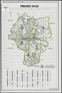
Precinct atlas, Town of Wakefield
59.
Atlas of the city of Boston : West Roxbury
60.
Atlas of the city of Boston : Dorchester
61.
Atlas of the city of Boston : Boston proper and Back Bay
62.
Atlas of the city of Boston : Dorchester
63.
Atlas of the city of Boston : Boston proper and Back Bay
64.
Atlas of the city of Boston : Dorchester, Mass., vol. 5
65.
Atlas of the city of Boston : South Boston
66.
Atlas of the city of Boston : volume 7, Brighton
67.
Atlas of the city of Boston : vol. 5, West Roxbury
68.
Atlas of the city of Boston : Boston proper and Roxbury
69.
Atlas of the city of Boston : Boston proper
70.
Atlas of the city of Boston : Dorchester, Massachusetts, vol. 5
71.
Atlas of the city of Boston : volume 6, West Roxbury
72.
Atlas of the city of Boston : vol. 5, Dorchester, Mass.
73.
Atlas of the city of Boston : East Boston
74.
Atlas of the city of Boston : ward 25 Brighton
75.
Atlas of the city of Boston : Boston proper and Back Bay
76.
Atlas of the city of Boston : West Roxbury
77.
Atlas of the city of Boston : Roxbury
78.
Atlas of the city of Boston : wards 25 and 26, Brighton
79.
Atlas of the city of Boston : Boston proper and Back Bay
80.
Atlas of Haverhill and Bradford, Massachusetts
81.
Atlas of the city of Boston : Roxbury
82.
Atlas of the city of Boston : South Boston
83.
Atlas of the city of Boston : ward 26 Hyde Park
84.
Atlas of the city of Boston : Dorchester
85.
Atlas of the city of Boston : Boston proper and Back Bay
86.
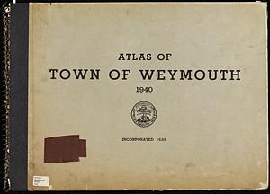
Atlas of Town of Weymouth, Massachusetts
87.
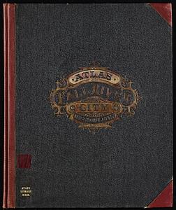
Atlas of Fall River City, Massachusetts
88.
Contents of composite atlas volume 2
89.
Atlas of Haverhill and Bradford, Massachusetts
90.
Atlas of New Bedford city, Massachusetts
91.
Robinson's atlas of Norfolk County, Massachusetts : compiled from official records, private plans & actual surveys
92.
Atlas of Fall River City, Massachusetts
93.
Atlas of the town of Wayland
94.
Atlas of town of Weymouth Massachusetts
95.
Atlas of town of Weymouth Massachusetts
96.
Atlas of town of Weymouth Massachusetts
97.
Atlas of Abington and Rockland, Massachusetts : from recent and actual surveys & records
98.
Atlas to Marshall's life of Washington
99.
Atlas of the city of Salem, Massachusetts : based on plans in the office of the City Engineer
100.
Richards standard atlas of Hampden County, Massachusetts : based upon, and carefully compiled from, the official plans, surveys...
‹ Prev
Next ›
1
2
3
4
5
…
28
29


![The West Indian atlas [frontispiece]](https://bpldcassets.blob.core.windows.net/derivatives/images/commonwealth:3f462x83x/image_thumbnail_300.jpg)