Precinct atlas, Town of Wakefield
Item Information
- Title:
- Precinct atlas, Town of Wakefield
- Name on Item:
-
compiled by he Department of Public Works, Engineering division
- Date:
-
2000
- Format:
-
Maps/Atlases
- Location:
- Lucius Beebe Memorial Library
- Collection (local):
-
Lucius Beebe Memorial Library Historic Maps
- Subjects:
-
Election districts
- Places:
-
Middlesex (county)Wakefield
- Extent:
- 1 map : b&w with hand coloring ; 91 x 61 cm.
- Terms of Use:
-
No known copyright restrictions.
No known restrictions on use.
- Publisher:
-
Wakefield, Mass. :
Dept. of Public Works
- Scale:
-
Scale: [ca. 1:12,000]
- Language:
-
English
- Notes:
-
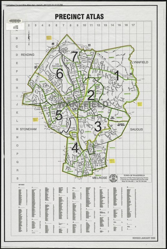
Revised January 2000.
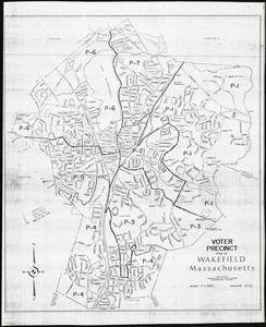
Map depicts entire town of Wakefield in 2000, showing the seven voter precincts, as well as streets, school locations, and highway exit numbers. The map is hand-colored to show U.S. Census 2000 geography. Census tract boundaries are outlined in yellow, and census block groups are outlined in green.
- Call #:
-
Local History Map Case Wakefield 2000-1
- Barcode:
-
31392003576802