Voter precinct map of Wakefield, Massachusetts
Item Information
- Title:
- Voter precinct map of Wakefield, Massachusetts
- Name on Item:
-
compiled by the Department of Public Works, Engineering division
- Date:
-
1992
- Format:
-
Maps/Atlases
- Location:
- Lucius Beebe Memorial Library
- Collection (local):
-
Lucius Beebe Memorial Library Historic Maps
- Subjects:
-
Election districts
- Places:
-
Middlesex (county)Wakefield
- Extent:
- 1 map : b&w ; 53 x 45 cm.
- Terms of Use:
-
No known copyright restrictions.
No known restrictions on use.
- Publisher:
-
Wakefield, MA :
Dept. of Public Works
- Scale:
-
Scale 1:6,000
- Language:
-
English
- Notes:
-
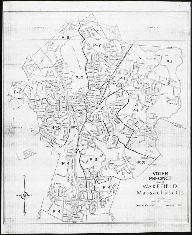
Map depicts entire town of Wakefield in 1992, showing the six voter precincts, as well as streets, schools, and other major public buildings.
- Call #:
-
Local History Map Case Wakefield 1992-1
- Barcode:
-
31392003576810