Toggle navigation
LMEC Home
Exhibitions
Georeferencing
Tools for Teachers
Collections
My Favorites
Sign Up / Log In
Search
Search the map portal
Map Collection
Map Collection
Map Sets
Search
Search
Search for
Search In
All Fields
Creator
Title
Subject
Place
Search All Digital Collections
Advanced Search
13548 Results
Filter your Search
Place
North and Central America
10,249
United States
8,381
Massachusetts
2,783
Suffolk (county)
1,677
Boston
1,633
Europe
1,395
Canada
950
New York
644
more
Place
»
Topic
Boston (Mass.)--Maps
747
City planning--Massachusetts--Boston--Maps
418
United States--History--Revolution, 1775-1783--Maps
329
United States--Maps
321
Real property--Massachusetts--Boston--Maps
254
Urban renewal--Massachusetts--Boston--Maps
254
Massachusetts--Maps
231
Insurance surveys
197
more
Topic
»
Date
Date range begin
–
Date range end
Current results range from
1482
to
2023
View distribution
Creator
United States. Hydrographic Office
596
Boston Redevelopment Authority
404
Des Barres, Joseph F. W. (Joseph Frederick Wallet), 1722-1824
247
Royal United Services Institute for Defence and Security Studies
160
Jefferys, Thomas, -1771
154
George, III, King of Great Britain, 1738-1820
152
George, IV, King of Great Britain, 1762-1830
151
O.H. Bailey & Co
148
more
Creator
»
Format
Maps/Atlases
13,367
Manuscripts
985
Prints
102
Books
49
Drawings/Illustrations
44
Photographs
15
Objects/Artifacts
13
Documents
7
more
Format
»
Georeferenced
Yes
979
No
12,569
Collection
Norman B. Leventhal Map & Education Center Collection
9,052
American Revolutionary War-Era Maps
3,305
Boston and New England Maps
2,906
Urban Maps
2,438
Maritime Charts and Atlases
1,168
William L. Clements Library Collection
910
Library of Congress Collection
618
Boston Redevelopment Authority Collection
475
more
Collection
»
Available to use
No known restrictions
10,115
Creative Commons license
1,677
Search Constraints
Sort by relevance
relevance
title
date (asc)
date (desc)
Number of results to display per page
20 per page
10
per page
20
per page
50
per page
100
per page
View results as:
grid view
map view
Search Results
13241.
Water system map, Boston proper, sheet no. 22h
13242.
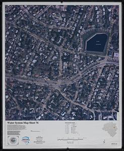
Water system map sheet 76 city of Newton, Mass.
13243.
Waterfront land inventory South Boston : CRP port study
13244.
Waterfront project, Pierhead Line, Boston, Mass.
13245.
Waterfront skyline
13246.
Watershed of the Lake of the Woods
13247.
Waupaca County, Wis.
13248.
Waushara, Marquette, and Green Lake Counties, Wis.
13249.
We must have order
13250.
Webster Loom Harness Co. (Wood Working), Fall River, Mass. [insurance map]
13251.
Weiterführung der Rheinischen Eisenbahn : general übersicht
13252.
Weller's political map of the United States : showing the plurality vote of the presidential election of 1892, in all states...
13253.
Wellhead protection areas in southeastern Massachusetts
13254.
Wellhead protection areas in southeastern Massachusetts
13255.
Welt-karte zur übersicht der meeres-strömungen und des schnellverkehrs
13256.
Wereldkaart "reis om de wereld"
13257.
West Boylston, Massachusetts : 1891
13258.
West Brookfield
13259.
West Canton Community Park
13260.
West coast of Africa, Liberia, St. Paul River
‹ Prev
Next ›
1
2
…
659
660
661
662
663
664
665
666
667
…
677
678


![Webster Loom Harness Co. (Wood Working), Fall River, Mass. [insurance map]](https://bpldcassets.blob.core.windows.net/derivatives/images/commonwealth:ww72bx506/image_thumbnail_300.jpg)


