Toggle navigation
LMEC Home
Exhibitions
Georeferencing
Tools for Teachers
Collections
My Favorites
Sign Up / Log In
Search
Search the map portal
Map Collection
Map Collection
Map Sets
Search
Search
Search for
Search In
All Fields
Creator
Title
Subject
Place
Search All Digital Collections
Advanced Search
5279 Results
My Search
Start Over
Date Range
before 1800
Remove constraint Date Range: before 1800
Filter your Search
Place
North and Central America
3,718
United States
2,498
Canada
655
Europe
646
Massachusetts
471
New York
376
North America
307
Maine
205
more
Place
»
Topic
United States--History--Revolution, 1775-1783--Maps
323
North America--Maps--Early works to 1800
179
United States--History--French and Indian War, 1754-1763--Maps
161
Manuscript maps--Early works to 1800
137
New England--Maps--Early works to 1800
89
World maps--Early works to 1800
76
America--Maps--Early works to 1800
73
Saint Lawrence River--Maps
63
more
Topic
»
Date
Date range begin
–
Date range end
Current results range from
1482
to
1990
View distribution
Creator
Des Barres, Joseph F. W. (Joseph Frederick Wallet), 1722-1824
245
Royal United Services Institute for Defence and Security Studies
158
Jefferys, Thomas, -1771
153
George, III, King of Great Britain, 1738-1820
152
George, IV, King of Great Britain, 1762-1830
151
Amherst, Jeffery Amherst, Baron, 1717-1797
130
Sayer, Robert, 1725-1794
107
Faden, William, 1749-1836
106
more
Creator
»
Format
Maps/Atlases
5,166
Manuscripts
787
Prints
59
Drawings/Illustrations
36
Books
11
Documents
5
Objects/Artifacts
3
Ephemera
1
Georeferenced
Yes
156
No
5,123
Collection
American Revolutionary War-Era Maps
3,277
Norman B. Leventhal Map & Education Center Collection
2,089
William L. Clements Library Collection
905
Library of Congress Collection
618
Town plans, 1794
403
British Library Collection
375
Maritime Charts and Atlases
371
Richard H. Brown Revolutionary War Map Collection at Mount Vernon
294
more
Collection
»
Available to use
No known restrictions
2,467
Creative Commons license
1,559
Search Constraints
Sort by relevance
relevance
title
date (asc)
date (desc)
Number of results to display per page
20 per page
10
per page
20
per page
50
per page
100
per page
View results as:
grid view
map view
Search Results
1621.
The island and colony of Cayenne subject to the French, on the continent of South America
1622.
The island of Antego
1623.
The island of Barbadoes : divided into its parishes, with the roads, paths, &c. according to an actual and accurate survey
1624.
The island of Bermudos divided into its tribes, with the castles, forts &c
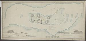
1625.
[Island of Coudre]
1626.
Island of Dominica
1627.
The island of Hispaniola called by the French St. Domingo : subject to France & Spain
1628.
The island of Jamaica
1629.
The island of Jamaica, divided into its principal parishes, with the roads &c
1630.
The island of St. Christophers, alias St. Kitts
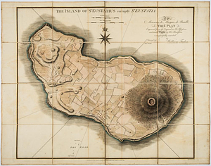
1631.
The island of St Eustatius corruptly St Eustatia : to Monsieur le Marquie de Bouillé this plan engraved from the original in...
1632.
The island of St. Eustatius corruptly St. Eustatia
1633.
[Island of St. Peters]
1634.
Isle aux Noix
1635.
L'Isle de France et lieux circövoysins
1636.
Isle de la Guadeloupe
1637.
L'isle de la Martinique : scituée a 14 degrez 30 minutes de latitude septentrionale
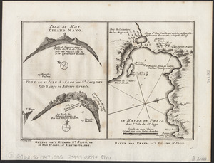
1638.
Isle de May ; Veue de l'isle de S. Jago ou St. Jacques, Ville S. Jago ou Ribeyro Grande ; Le havre de Praya dans l'isle de St....
1639.
Isle de Newyork : reconnaissance des ouvrages du nord de lisle de Newyork faite en presence des Généraux, Wasington et...
1640.
L'Isle de Terre-Neuve, l'Acadie, ou la Nouvelle Ecosse, : l'Isle St. Jean et la partie orientale du Canada
‹ Prev
Next ›
1
2
…
78
79
80
81
82
83
84
85
86
…
263
264


![[Island of Coudre]](https://bpldcassets.blob.core.windows.net/derivatives/images/commonwealth:hx11z0658/image_thumbnail_300.jpg)


![[Island of St. Peters]](https://bpldcassets.blob.core.windows.net/derivatives/images/commonwealth:cj82m507n/image_thumbnail_300.jpg)