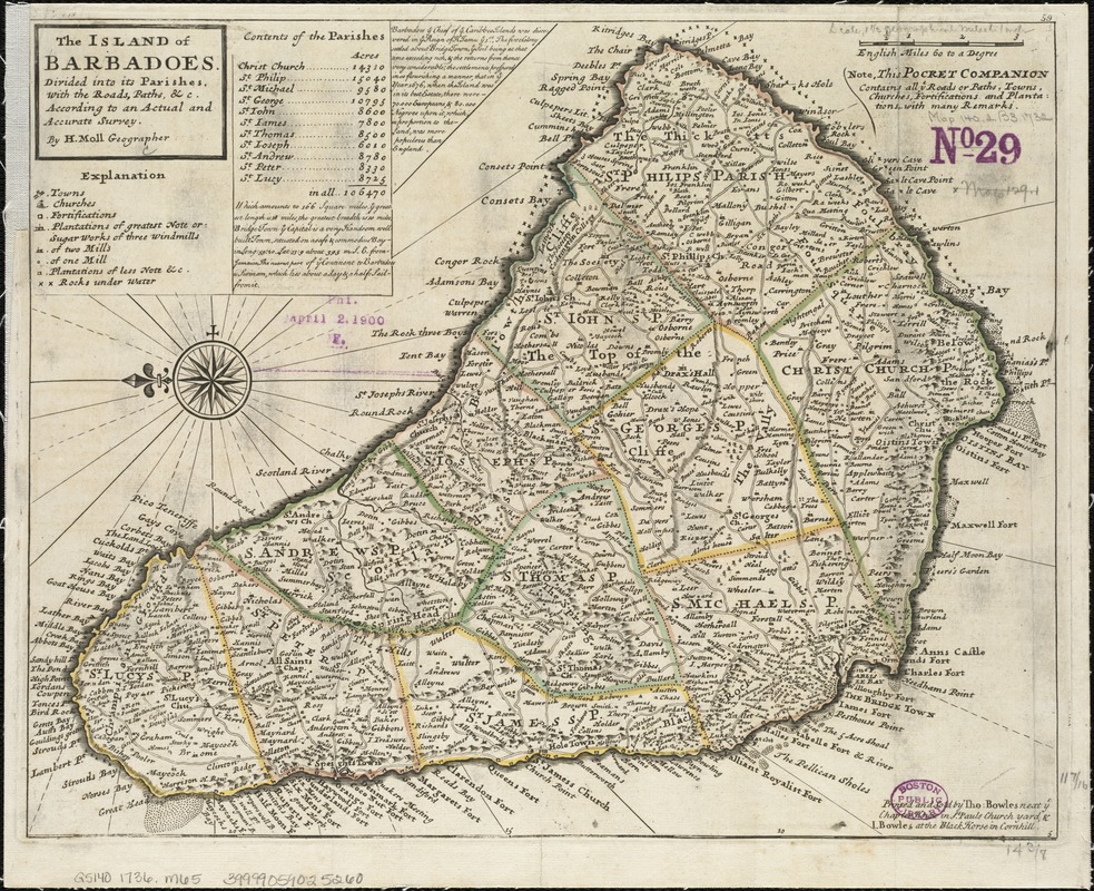
The island of Barbadoes : divided into its parishes, with the roads, paths, &c. according to an actual and accurate survey
Item Information
- Title:
- The island of Barbadoes : divided into its parishes, with the roads, paths, &c. according to an actual and accurate survey
- Creator:
- Moll, Herman, d. 1732
- Name on Item:
-
by H. Moll.
- Date:
-
[1736]
- Format:
-
Maps/Atlases
- Location:
-
Boston Public Library
Norman B. Leventhal Map & Education Center - Collection (local):
-
Norman B. Leventhal Map & Education Center Collection
- Subjects:
-
Barbados--Maps--Early works to 1800
- Places:
-
Barbados
- Extent:
- 1 map ; 29 x 37 cm.
- Terms of Use:
-
No known copyright restrictions.
No known restrictions on use.
- Publisher:
-
[London] :
Printed and sold by Tho. Bowles & John Bowles
- Scale:
-
Scale [ca. 1:85000]
- Language:
-
English
- Notes:
-
Relief shown pictorially.
Shows churches, forts, plantations, windmills, submerged rocks, etc.
Includes table of areas of parishes and geographical note.
Oriented with north toward left.
In upper right margin: 59.
Appears in the author's Atlas minor. London : Thomas Bowles and John Bowles, [1736].
- Notes (date):
-
This date is inferred.
- Identifier:
-
06_01_006379
- Call #:
-
G5140 1736 .M65
- Barcode:
-
39999059025260