The island of Jamaica, divided into its principal parishes, with the roads &c
Item Information
- Title:
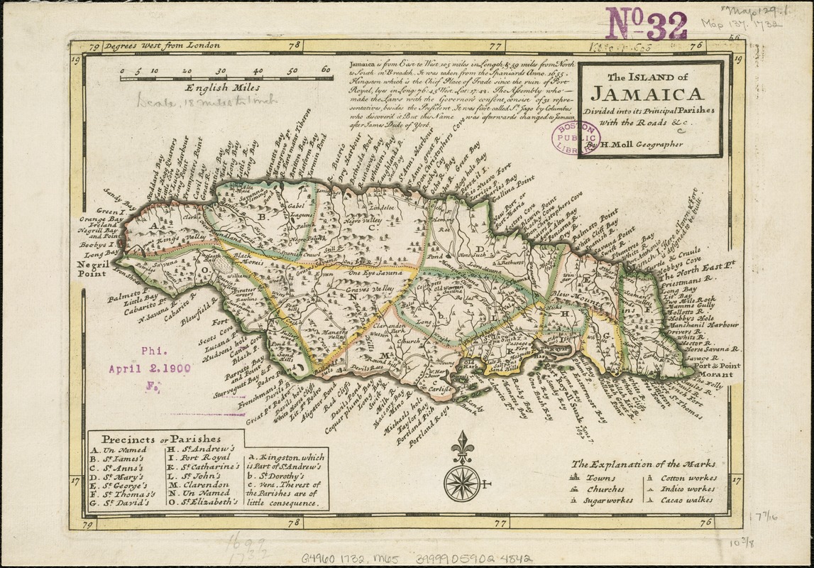
- The island of Jamaica, divided into its principal parishes, with the roads &c
- Creator:
- Moll, Herman, d. 1732
- Name on Item:
-
by H. Moll.
- Date:
-
[1732?]
- Format:
-
Maps/Atlases
- Location:
-
Boston Public Library
Norman B. Leventhal Map & Education Center - Collection (local):
-
Norman B. Leventhal Map & Education Center Collection
- Subjects:
-
Jamaica--Maps--Early works to 1800
- Places:
-
Jamaica
- Extent:
- 1 map : hand col. ; 19 x 27 cm.
- Terms of Use:
-
No known copyright restrictions.
No known restrictions on use.
- Publisher:
-
London? :
s.n.
- Scale:
-
Scale [ca. 1:1,075,000]
- Language:
-
English
- Notes:
-
Shows precincts or parishes, towns, churches and industries (sugar, cotton, indigo, cacao).
Relief shown pictorially.
Prime meridian: London.
Detached from unidentified source.
Political boundaries outlined in color.
Originally issued in 2 sheets.
In upper right margin: 56.
In manuscript, upper right border: Vol. 8, p. 606.
Cataloging, conservation, and digitization made possible in part by The National Endowment for the Humanities: Exploring the human endeavor.
- Identifier:
-
06_01_006342
- Call #:
-
G4960 1732 .M65
- Barcode:
-
39999059024842