Toggle navigation
LMEC Home
Exhibitions
Georeferencing
Tools for Teachers
Collections
My Favorites
Sign Up / Log In
Search
Search the map portal
Map Collection
Map Collection
Map Sets
Search
Search
Search for
Search In
All Fields
Creator
Title
Subject
Place
Search All Digital Collections
Advanced Search
10713 Results
My Search
Start Over
All Fields
americas
Remove constraint All Fields: americas
Filter your Search
Place
North and Central America
10,111
United States
8,243
Massachusetts
2,691
Suffolk (county)
1,662
Boston
1,619
Canada
936
New York
640
Middlesex (county)
424
more
Place
»
Topic
Boston (Mass.)--Maps
740
City planning--Massachusetts--Boston--Maps
418
United States--History--Revolution, 1775-1783--Maps
327
United States--Maps
313
Urban renewal--Massachusetts--Boston--Maps
254
Real property--Massachusetts--Boston--Maps
252
Massachusetts--Maps
219
Insurance surveys
194
more
Topic
»
Date
Date range begin
–
Date range end
Current results range from
1507
to
2023
View distribution
Creator
Boston Redevelopment Authority
403
United States. Hydrographic Office
365
Des Barres, Joseph F. W. (Joseph Frederick Wallet), 1722-1824
197
Jefferys, Thomas, -1771
150
George, III, King of Great Britain, 1738-1820
146
O.H. Bailey & Co
146
George, IV, King of Great Britain, 1762-1830
145
Royal United Services Institute for Defence and Security Studies
139
more
Creator
»
Format
Maps/Atlases
10,590
Manuscripts
916
Prints
60
Books
43
Drawings/Illustrations
43
Photographs
15
Objects/Artifacts
7
Posters
3
more
Format
»
Georeferenced
Yes
823
No
9,890
Collection
Norman B. Leventhal Map & Education Center Collection
6,479
American Revolutionary War-Era Maps
3,123
Boston and New England Maps
2,801
Urban Maps
2,249
William L. Clements Library Collection
892
Maritime Charts and Atlases
802
Library of Congress Collection
552
Boston Redevelopment Authority Collection
475
more
Collection
»
Available to use
No known restrictions
7,530
Creative Commons license
1,540
Search Constraints
Sort by relevance
relevance
title
date (asc)
date (desc)
Number of results to display per page
20 per page
10
per page
20
per page
50
per page
100
per page
View results as:
grid view
map view
Search Results
1701.
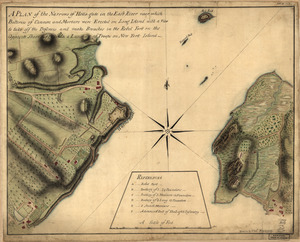
A plan of the Narrows of Hells-gate in the East River : near which batteries of cannon and mortars were erected on Long Island...
1702.
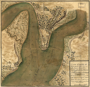
Carte detaillée de West Point sur la rivière d'York au confluent des Rivières de Pamunkey et Matapony
1703.
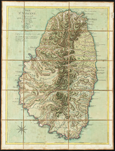
Isle St. Vincent
1704.
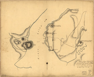
Plan of the attack of Fort Clinton and Montgomery which where [sic] stormed by His Majesty's forces : under the command of Sr....
1705.
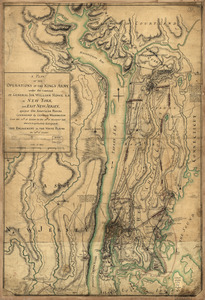
A plan of the operations of the King's army : under the command of General Sir William Howe, K.B. in New York and east New...
1706.
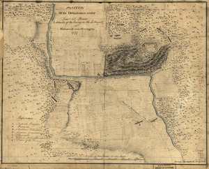
Position of the detachment under Lieut't Col. Baum & attacks of the enemy on the 16th August at Walmscock near Benington, 1777
1707.
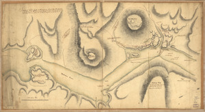
Sketch of Forts Clinton & Montgomery : stormed the 6th Octob. 1777 by the troops under the command of Sir Henry Clinton, K.B.,...
1708.
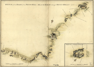
Sketch of Haddonfield, March 1778 : Sketch of the roads from Pennyhill to Black Horse through Mount Holly
1709.
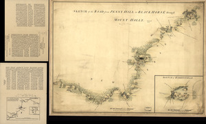
Sketch of Haddonfield. Sketch of the road from Penny Hill to Black Horse through Mount Holly, 1778
1710.
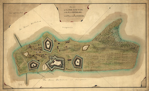
Map of Stony and Verplanck Points on the Hudson River as fortified by Sir Henry Clinton June 1779
1711.
Sketch of Stoney & Verplank's Points upon the North River : as taken possession of, and fortified by His Excellency Sir H:...
1712.
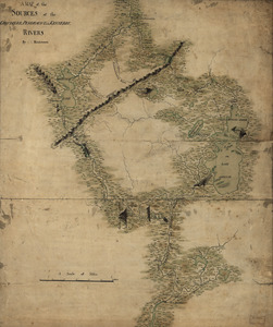
A map of the sources of the Chaudière, Penobscot, and Kennebec rivers
1713.
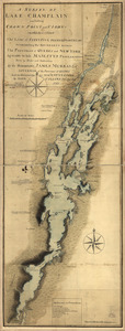
A survey of Lake Champlain including Crown Point and St. Iohn's : on which is fixed the line of forty five degrees north...
1714.
Plan of the Isle aux Noix, in the River Richelieu, and Province of Canada
1715.
Plano del Puerto de la Mobila : Situado en latd. No. de 30⁰ 10ʹ m. tomado á los Ingleses el dia 14 de Marzo de 1780
1716.
Part of a map of the Hudson Highlands showing Forts Clinton and Montgomery
1717.
North view of Pensacola, on the island of Santa Rosa ; Plan of the harbour and settlement of Pensacola
1718.
The above plan is a discription of a new township called Royalsborough in the county of Cumberland : bounded southeasterly on...
1719.
La Barbade
1720.
British camp at Trudruffrin from [sic] : with the attack made by Major General Grey against the rebels near White Horse Tavern
‹ Prev
Next ›
1
2
…
82
83
84
85
86
87
88
89
90
…
535
536
![Plan of the attack of Fort Clinton and Montgomery which where [sic] stormed by His Majesty's forces](https://bpldcassets.blob.core.windows.net/derivatives/images/commonwealth:q524nj90k/image_thumbnail_300.jpg)


![British camp at Trudruffrin from [sic]](https://bpldcassets.blob.core.windows.net/derivatives/images/commonwealth:q524nb58k/image_thumbnail_300.jpg)