Toggle navigation
LMEC Home
Exhibitions
Georeferencing
Tools for Teachers
Collections
My Favorites
Sign Up / Log In
Search
Search the map portal
Map Collection
Map Collection
Map Sets
Search
Search
Search for
Search In
All Fields
Creator
Title
Subject
Place
Search All Digital Collections
Advanced Search
10713 Results
My Search
Start Over
All Fields
americas
Remove constraint All Fields: americas
Filter your Search
Place
North and Central America
10,111
United States
8,243
Massachusetts
2,691
Suffolk (county)
1,662
Boston
1,619
Canada
936
New York
640
Middlesex (county)
424
more
Place
»
Topic
Boston (Mass.)--Maps
740
City planning--Massachusetts--Boston--Maps
418
United States--History--Revolution, 1775-1783--Maps
327
United States--Maps
313
Urban renewal--Massachusetts--Boston--Maps
254
Real property--Massachusetts--Boston--Maps
252
Massachusetts--Maps
219
Insurance surveys
194
more
Topic
»
Date
Date range begin
–
Date range end
Current results range from
1507
to
2023
View distribution
Creator
Boston Redevelopment Authority
403
United States. Hydrographic Office
365
Des Barres, Joseph F. W. (Joseph Frederick Wallet), 1722-1824
197
Jefferys, Thomas, -1771
150
George, III, King of Great Britain, 1738-1820
146
O.H. Bailey & Co
146
George, IV, King of Great Britain, 1762-1830
145
Royal United Services Institute for Defence and Security Studies
139
more
Creator
»
Format
Maps/Atlases
10,590
Manuscripts
916
Prints
60
Books
43
Drawings/Illustrations
43
Photographs
15
Objects/Artifacts
7
Posters
3
more
Format
»
Georeferenced
Yes
823
No
9,890
Collection
Norman B. Leventhal Map & Education Center Collection
6,479
American Revolutionary War-Era Maps
3,123
Boston and New England Maps
2,801
Urban Maps
2,249
William L. Clements Library Collection
892
Maritime Charts and Atlases
802
Library of Congress Collection
552
Boston Redevelopment Authority Collection
475
more
Collection
»
Available to use
No known restrictions
7,530
Creative Commons license
1,540
Search Constraints
Sort by relevance
relevance
title
date (asc)
date (desc)
Number of results to display per page
20 per page
10
per page
20
per page
50
per page
100
per page
View results as:
grid view
map view
Search Results
1621.
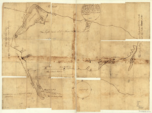
Map of Queens Village or Lloyd Neck in Queens County on the north side of Long Island in the Province (now State) of New York....
1622.
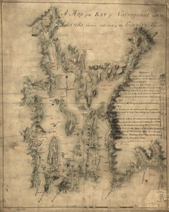
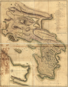
A map of the bay of Narraganset with the islands therein and part of the country adjacent
1623.
Map showing the Bowery Lane area of Manhattan
1624.
Map showing the west shore of the North or Hudson River
1625.
Marche de l'armée française de Providence à la Rivière du Nord
1626.
New York Island : Military; unfinished
1627.
New York Island. Military. Unfinished
1628.
Nord de l'Ile de New-York
1629.
The Part of Pennsylvania that lies between the forks of the Susquehannah, divided into townships
1630.
Penobscot River and Bay, with the operations of the English fleet, under Sir George Collyer : against the division of...
1631.
Plan de la position de l'armée françoise autour de Newport et du mouillage de l'escadre dans la rade de cette ville
1632.
Plan de la ville, du port, et de la rade de New-port et Rhode Island : Debarquement en 1780
1633.
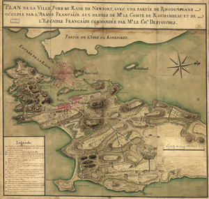
Plan de la ville, port, et rade de Newport : avec une partie de Rhode-Island occupée par l'armée française aux ordres de Mr....
1634.
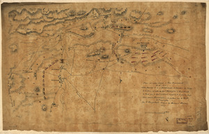
Plan de notre camp à New Brunswick le 12e. juin : notre marche le 14 à Middlebush, la situation du camp le 15e juin, et cette...
1635.
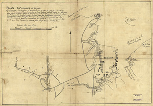
Plan de Portsmouth en Virginie
1636.
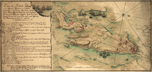
Plan de Rhode Island et les differentes operations de la flotte-françoises et des troupes americaines : commandées par le...
1637.
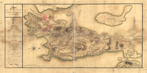
Plan de Rhodes-Island, et position de l'armée françoise a Newport
1638.
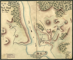
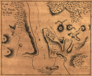
Plan de West-Point du nord, levé a vue
1639.
Plan de West-Pointe du nord levé a vue
1640.
Plan des ouvrages de Portsmouth en Virginie
‹ Prev
Next ›
1
2
…
78
79
80
81
82
83
84
85
86
…
535
536