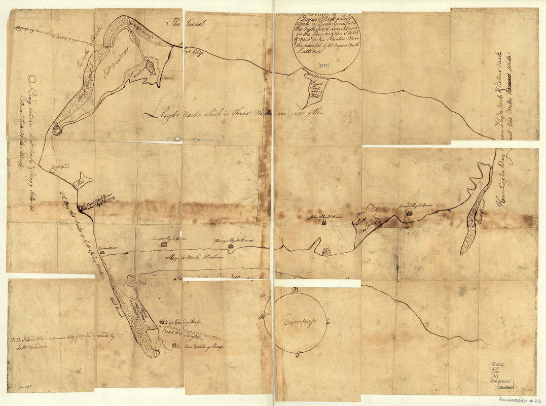
Map of Queens Village or Lloyd Neck in Queens County on the north side of Long Island in the Province (now State) of New York. Situated near the parallel of 41 degrees north lattitude
This map is also available in American Revolutionary Geographies Online (ARGO), a collections portal especially built for material relating to the American Revolutionary War Era. Visit ARGO to learn more about this item and explore the historical geography of North America in the late eighteenth century.
Item Information
- Title:
- Map of Queens Village or Lloyd Neck in Queens County on the north side of Long Island in the Province (now State) of New York. Situated near the parallel of 41 degrees north lattitude
- Title (alt.):
-
Queens Village or Lloyd Neck
- Date:
-
[1781]
- Format:
-
Maps/Atlases
Manuscripts
- Location:
- Library of Congress Geography and Map Division
- Collection (local):
-
Library of Congress Collection
- Subjects:
-
Lloyd Neck, N.Y. (Suffolk Co.)--Maps, Manuscript--Early works to 1800
- Places:
-
Suffolk (county)Lloyd Neck (area)
- Extent:
- 1 manuscript map, on sheet 67 x 92 cm.
- Terms of Use:
-
No known copyright restrictions.
This work is licensed for use under a Creative Commons Attribution Non-Commercial Share Alike License (CC BY-NC-SA).

- Scale:
-
Scale ca. 1:2,000
- Language:
-
English
- Catalog Record:
-
https://lccn.loc.gov/gm71000987
- Notes:
-
Manuscript, pen-and-ink.
Has watermarks.
A sketch map showing locations of houses, with owners' names, ponds, etc. A "fort block house built by ye enemy" [i.e. British] and "An inlet where whale boats & barges may be secreted" are of Revolutionary War interest.
- Notes (date):
-
This date is inferred.
- Notes (citation):
-
LC Maps of North America, 1750-1789, 1202
- Identifier:
-
ar120200z


