Toggle navigation
LMEC Home
Exhibitions
Georeferencing
Tools for Teachers
Collections
My Favorites
Sign Up / Log In
Search
Search the map portal
Map Collection
Map Collection
Map Sets
Search
Search
Search for
Search In
All Fields
Creator
Title
Subject
Place
Search All Digital Collections
Advanced Search
11255 Results
My Search
Start Over
All Fields
americas
Remove constraint All Fields: americas
Filter your Search
Place
North and Central America
10,642
United States
8,658
Massachusetts
2,807
Suffolk (county)
1,679
Boston
1,635
Canada
987
New York
670
Middlesex (county)
441
more
Place
»
Topic
Boston (Mass.)--Maps
747
City planning--Massachusetts--Boston--Maps
418
United States--History--Revolution, 1775-1783--Maps
329
United States--Maps
325
Real property--Massachusetts--Boston--Maps
254
Urban renewal--Massachusetts--Boston--Maps
254
North America--Maps--Early works to 1800
235
Massachusetts--Maps
234
more
Topic
»
Date
Date range begin
–
Date range end
Current results range from
1507
to
2023
View distribution
Creator
Boston Redevelopment Authority
404
United States. Hydrographic Office
366
Des Barres, Joseph F. W. (Joseph Frederick Wallet), 1722-1824
197
Jefferys, Thomas, -1771
166
George, III, King of Great Britain, 1738-1820
146
O.H. Bailey & Co
146
George, IV, King of Great Britain, 1762-1830
145
Royal United Services Institute for Defence and Security Studies
139
more
Creator
»
Format
Maps/Atlases
11,131
Manuscripts
919
Prints
60
Books
43
Drawings/Illustrations
43
Photographs
15
Objects/Artifacts
7
Posters
4
more
Format
»
Georeferenced
Yes
823
No
10,432
Collection
Norman B. Leventhal Map & Education Center Collection
6,636
American Revolutionary War-Era Maps
3,126
Boston and New England Maps
2,918
Urban Maps
2,294
William L. Clements Library Collection
892
Maritime Charts and Atlases
817
Library of Congress Collection
555
Boston Redevelopment Authority Collection
475
more
Collection
»
Available to use
No known restrictions
7,784
Creative Commons license
1,544
Search Constraints
Sort by relevance
relevance
title
date (asc)
date (desc)
Number of results to display per page
20 per page
10
per page
20
per page
50
per page
100
per page
View results as:
grid view
map view
Search Results
10641.
View of Cape Egmont and winter Rock from the eastward : Entrance of Egmont Harbor ; The entrance of Keppel Harbor, 10 leagues...
10642.
A view of the Great Bridge near Norfolk in Virginia where the action happened between a detachment of the 14th Regt: & a body...
10643.
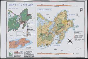
Views of Cape Ann
10644.
Vineyard Haven, Dukes County, Martha's Vineyard, Massachusetts : the popular seaside summer resort
10645.
Wakefield and Peace Dale, Rhode Island : 1888
10646.
West Indies, banks in the Caribbean Sea : from British surveys corrected to 1872
10647.
West Indies, island of Santo Domingo, approaches to Port au Prince : compiled from the latest information 1887
10648.
West Indies, island of Santo Domingo, Caldera Bay : from a survey in 1870 by the officers of the U.S.S. Nantasket, Lt. Comdr....
10649.
West Indies, Virgin Islands, St. Thomas
10650.
West Indies, west coast of Haiti, Port au Prince : from a French survey in 1847 corrected for the latest information, 1886
10651.
West-Indies, special plans to chart no. 26c, Bahama Bank : from British surveys, corrected to 1872
10652.
Whitman National Forest, Blue Mountains Division, Oregon
10653.
Whitman National Forest, Minam Division, Oregon
10654.
South Pacific
10655.
[A map of Fort Carillon and environs]
10656.
[A map of Fort Carillon and environs]
10657.
[A map of the southern part of the Lake Champlain, from "Tienderoga fort" to Crown Point]
10658.
[A map showing the northern part of Lake George and Fort Ticonderoga]
10659.
[A map showing the post route between the River St. Lawrence and the Bay of Fundy] : [on a scale of 5 1/3 miles to an inch.]
10660.
[A map showing the post route between the River St. Lawrence and the Bay of Fundy] : [on a scale of 5 1/3 miles to an inch.]
‹ Prev
Next ›
1
2
…
529
530
531
532
533
534
535
536
537
…
562
563


![[A map of Fort Carillon and environs]](https://bpldcassets.blob.core.windows.net/derivatives/images/commonwealth:hx11z538d/image_thumbnail_300.jpg)
![[A map of Fort Carillon and environs]](https://bpldcassets.blob.core.windows.net/derivatives/images/commonwealth:hx11z342k/image_thumbnail_300.jpg)
![[A map of the southern part of the Lake Champlain, from "Tienderoga fort" to Crown Point]](https://bpldcassets.blob.core.windows.net/derivatives/images/commonwealth:6108vv78r/image_thumbnail_300.jpg)
![[A map showing the northern part of Lake George and Fort Ticonderoga]](https://bpldcassets.blob.core.windows.net/derivatives/images/commonwealth:hx11z3444/image_thumbnail_300.jpg)
![[A map showing the post route between the River St. Lawrence and the Bay of Fundy]](https://bpldcassets.blob.core.windows.net/derivatives/images/commonwealth:hx11z4963/image_thumbnail_300.jpg)
![[A map showing the post route between the River St. Lawrence and the Bay of Fundy]](https://bpldcassets.blob.core.windows.net/derivatives/images/commonwealth:hx11z498n/image_thumbnail_300.jpg)