The state of Massachusetts
This map is also available in American Revolutionary Geographies Online (ARGO), a collections portal especially built for material relating to the American Revolutionary War Era. Visit ARGO to learn more about this item and explore the historical geography of North America in the late eighteenth century.
Item Information
- Title:
- The state of Massachusetts
- Description:
-
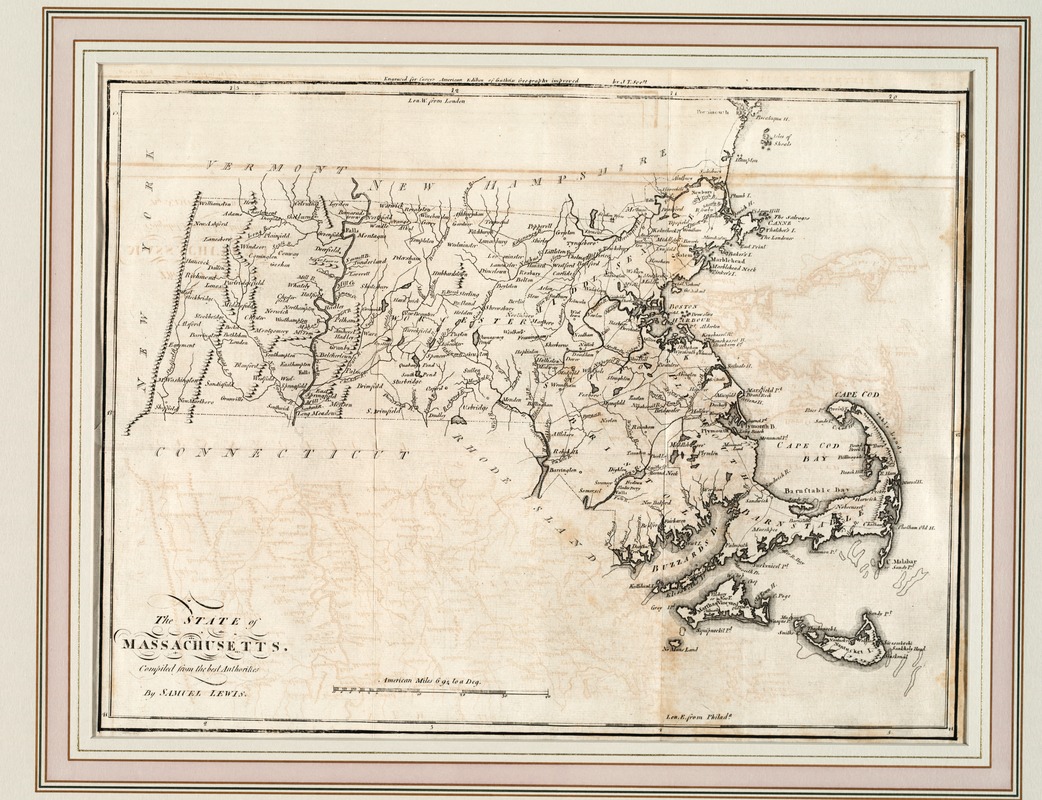
This is the first state map of Massachusetts to be published in the young republic. The Massachusetts state government, realizing that efficient communications, not just postal routes and roads, but also canals, rivers, and bridges were the key to prosperity and power, began to consider an official state mapping project as early as 1792. Samuel Lewis' map served as a useful interim map during the nine-year campaign that led to the first official state map completed by Osgood Carleton in 1801. It is the work of Samuel Lewis that appeared in Mathew Carey's "General Atlas" published to accompany Carey's American edition of "Guthrie's Geography Improved", a popular geography textbook which was first issued in London in 1770.
- Creator:
- Lewis, Samuel, 1753 or 4-1822
- Name on Item:
-
compiled from the best authorities by Samuel Lewis.
- Date:
-
[1795]
- Format:
-
Maps/Atlases
- Location:
- Private Collection
- Collection (local):
-
Mapping Boston Collection
- Subjects:
-
Massachusetts--Maps--Early works to 1800
- Places:
-
Massachusetts
- Extent:
- 1 map ; 42 x 55 cm.
- Terms of Use:
-
No known copyright restrictions.
This work is licensed for use under a Creative Commons Attribution Non-Commercial Share Alike License (CC BY-NC-SA).

- Publisher:
-
Philadelphia :
Mathew Carey
- Scale:
-
Scale [ca. 1:675,840]
- Language:
-
English
- Notes:
-
Relief shown pictorially.
"Engraved for Carey's American edition of Guthrie's Geography improved, by J.T. Scott." [Philadelphia : M. Carey, 1795.].
Prime meridians: London (top) and Philadelphia (bottom).
- Notes (date):
-
This date is inferred.
- Identifier:
-
05_04_000071
- Barcode:
-
39999052509393


