Toggle navigation
LMEC Home
Exhibitions
Georeferencing
Tools for Teachers
Collections
My Favorites
Sign Up / Log In
Search
Search the map portal
Map Collection
Map Collection
Map Sets
Search
Search
Search for
Search In
All Fields
Creator
Title
Subject
Place
Search All Digital Collections
Advanced Search
44 Results
My Search
Start Over
Date
1989
Remove constraint Date: <span class='single'>1989</span>
Filter your Search
Place
North and Central America
40
United States
39
Boston
29
Suffolk (county)
29
Massachusetts
28
New England
5
Roxbury
5
Fens
4
more
Place
»
Topic
City planning--Massachusetts--Boston--Maps
13
Boston (Mass.)--Maps
6
Fenway (Boston, Mass.)--Maps
4
Real property--Massachusetts--Boston--Maps
4
Roxbury (Boston, Mass.)--Maps
4
Buildings--Massachusetts--Boston--Maps
3
New England--Maps--Early works to 1800--Facsimiles
3
Back Bay (Boston, Mass.)--Maps
2
more
Topic
»
Date
1989
[remove]
44
Date range begin
–
Date range end
Current results range from
1770
to
1999
1989
to
1989
44
Creator
Boston Redevelopment Authority
14
DMC Engineering, Inc.
2
MassGIS (Office : Mass.)
2
Metropolitan/Columbia Plaza Venture
2
Stull and Lee
2
Ammann & Whitney (Firm)
1
Boston (Mass.). Department of Parks. Board of Commissioners
1
Boston Society of Architects
1
more
Creator
»
Format
Maps/Atlases
40
Drawings/Illustrations
3
Ephemera
2
Prints
1
Georeferenced
No
44
Collection
Norman B. Leventhal Map & Education Center Collection
37
Boston and New England Maps
32
Urban Maps
27
Boston Redevelopment Authority Collection
25
David Judkins Weaver Papers
7
American Revolutionary War-Era Maps
1
Sidney R. Knafel Map Collection at Phillips Academy
1
Available to use
No known restrictions
43
Search Constraints
Sort by relevance
relevance
title
date (asc)
date (desc)
Number of results to display per page
20 per page
10
per page
20
per page
50
per page
100
per page
View results as:
grid view
map view
Search Results
1.
660 Wakulah St., Roxbury
2.
Allston-Brighton open space plan site inventory
3.
Architectural styles, Chinatown historic core, historic edge
4.
Boston City Hall ninth floor plan
5.
Boston University buildings
6.
Building #33, Charlestown Navy Yard flr. plans
7.
Central business district urban renewal area project no. Mass. R-82L site preparation contract T : planting plan and details
8.
A chart of the gulf stream
9.
Columbia Point development study
10.
A draught of St. John's harbour : with the soundings
11.
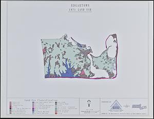
Edgartown 1971 to 1985 land use change
12.
Egleston Square improvement program
13.
Forest Hills improvement area
14.
FPIR/FEIR Olmsted Plaza : a redevelopment of the Sears property, 309 Park Drive/201 Brookline Avenue in the Fenway
15.
General plan of the MWRA/MDC water system
16.
Hancock Woods : as of right plan
17.
Illustration of a building at 290 Tremont St. in Boston
18.
James Hayes Park
19.
John Hancock office and parking garage complex, Boston, Massachusetts
20.
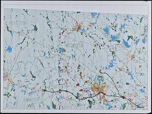
Land use in northern Worcester County, Mass. ; open spaces and protected areas in the northern Worcester County, Mass.
‹ Prev
Next ›
1
2
3