Toggle navigation
LMEC Home
Exhibitions
Georeferencing
Tools for Teachers
Collections
My Favorites
Sign Up / Log In
Search
Search the map portal
Map Collection
Map Collection
Map Sets
Search
Search
Search for
Search In
All Fields
Creator
Title
Subject
Place
Search All Digital Collections
Advanced Search
16 Results
My Search
Start Over
Norway
Remove constraint Norway
Filter your Search
Place
Europe
8
Norway
8
Scandinavia
3
Trondheim
2
Trøndelag (county)
2
Balkan Peninsula
1
Baltic Countries
1
Halden
1
more
Place
»
Topic
Norway--Maps
3
Swedish-Polish War, 1655-1660--Maps--Early works to 1800
3
Scandinavia--Maps
2
Trondheim (Norway)--Maps--Early works to 1800
2
1695
1
Balkan Peninsula--Administrative and political divisions--Maps--Early works to 1800
1
Balkan Peninsula--Maps--Early works to 1800
1
Baltic States--Maps--Early works to 1800
1
more
Topic
»
Date
Date range begin
–
Date range end
Current results range from
1680
to
1915
View distribution
Creator
Pufendorf, Samuel, Freiherr von, 1632-1694
3
Riegel, Christoph
3
Dahlbergh, Erik Jönsson, greve, 1625-1703
2
Bontz, Geo. F.
1
Bowen, Thomas, -1790
1
Carey, Mathew, 1760-1839
1
Great Britain. Admiralty
1
Great Britain. Hydrographic Office
1
more
Creator
»
Format
Maps/Atlases
16
Georeferenced
Yes
2
No
14
Collection
Norman B. Leventhal Map Center Collection
15
Maritime Charts and Atlases
2
Urban Maps
2
Town plans, 1794
1
Available to use
No known restrictions
16
Search Constraints
Sort by date (asc)
relevance
title
date (asc)
date (desc)
Number of results to display per page
20 per page
10
per page
20
per page
50
per page
100
per page
View results as:
grid view
map view
Search Results
1.
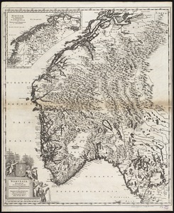
Norvegia regnum divisum in suos dioeceses Nidrosiensem, Bergensem, Opsloensem, et Stavangriensem et praefecturam Bahusiae quae...
2.
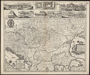
A new mapp of the Kingdom of Hungary and the states that have been subject to it, which are at present the northern parts of...
3.
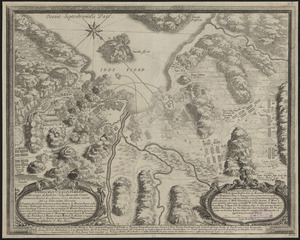
Delineatio oppidi Halldae in Norwegia ab Exell. Dn. Campi Marescallo Comite Laurentio Kagge, d. 21. Ianuar, 1660 obsidione...
4.
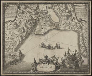
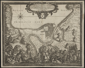
Delineatio urbis Nidrosiae vulgo, Dronheem in Norvegia, à Danis d. 28. Septem. obsessae et 11. Decemb. deditione capta an. 1658
5.
Ichnographia urbis Nidrosiae vulgo Dronheem in Norwegia eo statu, quo S.R.M. Sueciae vi pacis Rothschildica initae à Ser. Rege...
6.
A new map of Denmark and Sweden : according to ye newest and most exact observations
7.
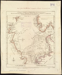
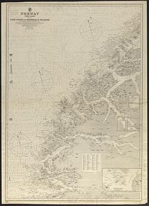
A correct chart of the North Sea, with the adjacent coasts of Britain, Holland, Germany, Denmark, Norway, the islands of Orkney...
8.
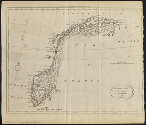
Norway, from the best authorities
9.
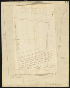
Plan of Norway (Rustfield), surveyor's name not given, dated December 1795.
10.
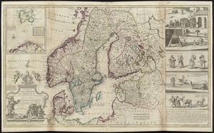
Sweden, Denmark, Norway and Finland : from the best authorities
11.
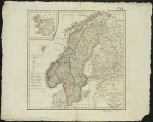
Charte von Schweden und Norwegen
12.
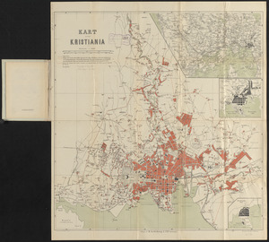
Kart over Kristiania
13.
Arctic Sea, Spitzbergen : from the Swedish survey of 1861 to 1864, corrected from the German & Norwegian explorations to 1872
14.
Bennett's tourists' route map of Norway
15.
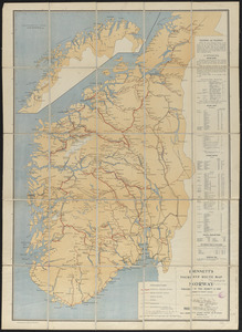
Norway, west coast : from Norwegian surveys, with corrections to 1886
16.
Strategic map of Central Europe showing the international frontiers