Toggle navigation
LMEC Home
Exhibitions
Georeferencing
Tools for Teachers
Collections
My Favorites
Sign Up / Log In
Search
Search the map portal
Map Collection
Map Collection
Map Sets
Search
Search
Search for
Search In
All Fields
Creator
Title
Subject
Place
Search All Digital Collections
Advanced Search
24 Results
My Search
Start Over
1978
Remove constraint 1978
Filter your Search
Place
North and Central America
21
United States
20
Boston
12
Suffolk (county)
12
Massachusetts
9
California
2
Fens
2
Park Square
2
more
Place
»
Topic
Boston (Mass.)--Maps
5
City planning--Massachusetts--Boston--Maps
4
Local transit--Massachusetts--Boston--Maps
3
Bicycle trails--Massachusetts--Boston--Maps
2
Boston Metropolitan Area (Mass.)--Maps
2
Bus rapid transit--Massachusetts--Boston--Maps
2
Fenway (Boston, Mass.)--Maps
2
Massachusetts Bay Transportation Authority
2
more
Topic
»
Date
Date range begin
–
Date range end
Current results range from
1745
to
1990
View distribution
Creator
Boston Redevelopment Authority
3
Geological Survey (U.S.)
3
General Drafting Company
2
Massachusetts Bay Transportation Authority
2
Weaver, David Judkins, 1951-
2
Allen, John S., 1946-
1
Barber, Luke
1
Boston (Mass.). Office of Program Development
1
more
Creator
»
Format
Maps/Atlases
24
Manuscripts
1
Georeferenced
Yes
1
No
23
Collection
Norman B. Leventhal Map & Education Center Collection
17
Boston and New England Maps
11
Urban Maps
10
Boston Redevelopment Authority Collection
7
Applied Geographics, Inc. Records
6
David Judkins Weaver Papers
3
Maritime Charts and Atlases
3
American Revolutionary War-Era Maps
1
more
Collection
»
Available to use
No known restrictions
23
Search Constraints
Sort by relevance
relevance
title
date (asc)
date (desc)
Number of results to display per page
20 per page
10
per page
20
per page
50
per page
100
per page
View results as:
grid view
map view
Search Results
1.
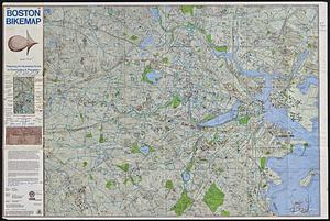
Free 1978 Boston bikemap : featuring an illustrated guide to commuting & recreation
2.
T system map : 1978-1979
3.
MBTA map : 1977-1978
4.
Wereldkaart "reis om de wereld"
5.
New Haven
6.
Port facilities at Boston, MA
7.
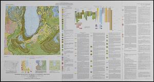
Geologic map of Mars
8.
Park Plaza urban renewal area : map no. 6 land disposal map
9.
South End urban renewal area project Mass. r-56 : site preparation contract no. 16 street lighting and drainage
10.
Park Plaza traffic improvements & grade level controls
11.
Quaternary geologic map of the Chicago 4° x 6° quadrangle, United States
12.
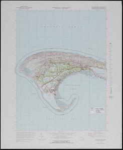
Provincetown quadrangle, Massachusetts-Barnstable Co., 1972 : 7.5 minute series (topographic)
13.
Boston's bikemap : Arlington, Belmont, Brookline, Cambridge, Chelsea, Everett, Lexington, Malden, Medford, Needham, Newton,...
14.
Plan du port et de la ville de Louisbourg : avec ses batteries et sa perspective, où est réprésenté les batteries faites...
15.
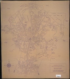
Wakefield, Massachusetts
16.
Selected hurricanes affecting the southern United States 1954-1977
17.
Boylston Street : Fenway to Massachusetts Avenue
18.
Major transportation system : Boston region MAPC area
19.
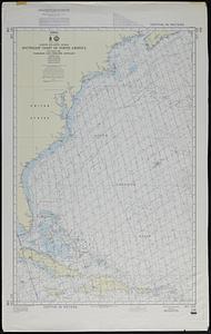
North Atlantic Ocean, southeast coast of North America, including the Bahamas and Greater Antilles
20.
Parcel 13 rehabilitation
‹ Prev
Next ›
1
2