Toggle navigation
LMEC Home
Exhibitions
Georeferencing
Tools for Teachers
Collections
My Favorites
Sign Up / Log In
Search
Search the map portal
Map Collection
Map Collection
Map Sets
Search
Search
Search for
Search In
All Fields
Creator
Title
Subject
Place
Search All Digital Collections
Advanced Search
1755 Results
My Search
Start Over
"new york"
Remove constraint "new york"
Filter your Search
Place
North and Central America
1,537
United States
1,410
New York
650
Massachusetts
147
New England
116
North America
87
New Jersey
85
Canada
73
more
Place
»
Topic
United States--History--Revolution, 1775-1783--Maps
92
New York (State)--Maps
82
United States--Maps
78
New England--Maps
59
North America--Maps--Early works to 1800
50
Manhattan (New York, N.Y.)--Maps
49
New York (N.Y.)--Maps
49
United States--History--French and Indian War, 1754-1763--Maps
49
more
Topic
»
Date
Date range begin
–
Date range end
Current results range from
1561
to
2020
View distribution
Creator
George, III, King of Great Britain, 1738-1820
52
George, IV, King of Great Britain, 1762-1830
52
American Geographical Society of New York
45
Royal United Services Institute for Defence and Security Studies
42
Amherst, Jeffery Amherst, Baron, 1717-1797
40
Walling, Henry Francis, 1825-1888
33
Beers, F. W. (Frederick W.)
28
Faden, William, 1749-1836
27
more
Creator
»
Format
Maps/Atlases
1,725
Manuscripts
152
Prints
25
Books
15
Drawings/Illustrations
2
Objects/Artifacts
2
Posters
1
Georeferenced
Yes
156
No
1,599
Collection
Norman B. Leventhal Map & Education Center Collection
1,001
American Revolutionary War-Era Maps
723
William L. Clements Library Collection
218
Urban Maps
211
Boston and New England Maps
204
New York Public Library Collection
122
British Library Collection
103
Library of Congress Collection
82
more
Collection
»
Available to use
No known restrictions
1,067
Creative Commons license
391
Search Constraints
Sort by relevance
relevance
title
date (asc)
date (desc)
Number of results to display per page
20 per page
10
per page
20
per page
50
per page
100
per page
View results as:
grid view
map view
Search Results
1741.
Suburban Boston teachers are the lowest earners
1742.
Topographical map of Fairmount Park, Philadelphia : excepting Wissahickon Valley
1743.
Victory map
1744.
Volunteer militia and eastern army guide : One hundred and fifty miles around Richmond
1745.
The world according to Standard (N.J.)
1746.
The countries of the Caribbean : including Mexico, Central America, the West Indies and the Panama Canal
1747.
Insurance map of Boston vol. 3 (South & East Boston)
1748.
Insurance maps of Boston volume one
1749.
Insurance maps of Boston volume two
1750.
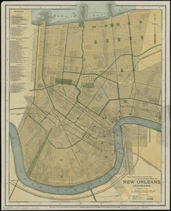
The Matthews-Northrup up-to-date map of New Orleans, Louisiana
1751.
Military map of the middle and southern states showing the seat of war during the great rebellion in 1861
1752.
Traveler's rail road map of the United States to accompany "Boston to Washington" Riverside Series Centennial Guides
1753.
Uprooted people of the U.S.A.
1754.
Insurance maps of Boston volume 4 : comprising portions of Charlestown, East Cambridge, Cambridge Port, Old Cambridge & Somerville
1755.
A two-way street between the Americas
‹ Prev
Next ›
1
2
…
84
85
86
87
88