Toggle navigation
LMEC Home
Exhibitions
Georeferencing
Tools for Teachers
Collections
My Favorites
Sign Up / Log In
Search
Search the map portal
Map Collection
Map Collection
Map Sets
Search
Search
Search for
Search In
All Fields
Creator
Title
Subject
Place
Search All Digital Collections
Advanced Search
190 Results
My Search
Start Over
Date
1925
to
1929
Remove constraint Date: <span class='from'>1925</span> to <span class='to'>1929</span>
Filter your Search
Place
North and Central America
163
United States
158
Massachusetts
49
Boston
32
Suffolk (county)
32
Asia
11
Bristol (county)
11
Europe
8
more
Place
»
Topic
Fire risk assessment
23
Insurance surveys
23
Textile factories
19
Boston (Mass.)--Maps
17
Cotton manufacture
9
Pictorial maps
6
Tokyo (Japan)--Maps
5
Landowners--Massachusetts--Boston--Maps
4
more
Topic
»
Date
1925
to
1929
[remove]
190
Date range begin
–
Date range end
Current results range from
1770
to
1999
1925
to
1925
57
1926
to
1926
55
1927
to
1927
56
1928
to
1928
67
1929
to
1929
38
Creator
Geological Survey (U.S.)
23
Associated Factory Mutual Fire Insurance Companies
12
Associated Mutual Insurance Companies
8
United States. Forest Service
7
Boston (Mass.). Department of Parks
6
Good, L. S.
5
Mehurin, E. L.
5
American Geographical Society of New York
4
more
Creator
»
Format
Maps/Atlases
189
Objects/Artifacts
1
Photographs
1
Georeferenced
Yes
6
No
184
Collection
Norman B. Leventhal Map & Education Center Collection
160
Boston and New England Maps
40
American Textile History Museum Image Collection
23
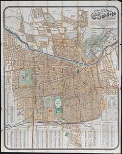
Urban Maps
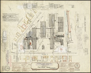
21
Massachusetts Real Estate Atlases
4
David Judkins Weaver Papers
3
American Revolutionary War-Era Maps
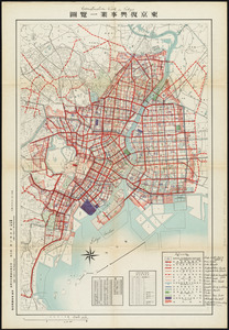
1
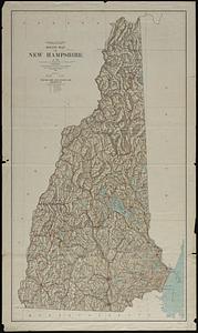
Campus Maps from Phillips Academy Archives and Special Collections
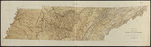
1
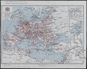
more
Collection
»
Available to use
No known restrictions
157
Creative Commons license
4
Search Constraints
Sort by relevance
relevance
title
date (asc)
date (desc)
Number of results to display per page
20 per page
10
per page
20
per page
50
per page
100
per page
View results as:
grid view
map view
Search Results
141.
Plan of corner of Centry & Beacon St's -- 1741
142.
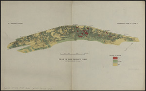
Plan of Isle Royale Lode : developments to 1925
143.
Plan of the burnt district : showing proposed improvements in streets. Nov. 12th 1872
144.
A plan of the town of Walpole taken by an actual survey in the month of October 1794 and layed down from a scale of 200 rods to...
145.
Plano jeneral de la ciudad de Santiago e inmediaciones : con el nuevo límite urbano de la ciudad, creacion de nuevas comunas,...
146.
Pleasant Street Realty Co. "Durfee Mills" (Cotton Mill), Fall River, Mass.
147.
Powdrell & Alexander, Inc. "Mill No. 3" (Connecticut Mills) (Cloth Working), Danielson, Conn. [insurance map]
148.
The Price & Lee Co's map of the city of Springfield Mass.
149.
Public reservations on the banks of the Charles River between Watertown and Cragies Bridge
150.
Puno - Rio Beni : South America 1:1,000,000
151.
Rand McNally standard map of Alaska
152.
Reconstruction work in Tokyo
153.
Relief map of New Hampshire
154.
Relief map, state of Tennessee
155.
Reseau parcouru par les voitures de la Compagnie Internationale des Wagons-lits
156.
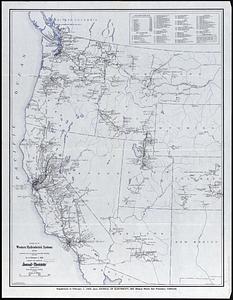
Revised map of western hydroelectric systems showing transmission lines, power plants and some major undeveloped power sites as...
157.
Route map of Massachusetts
158.
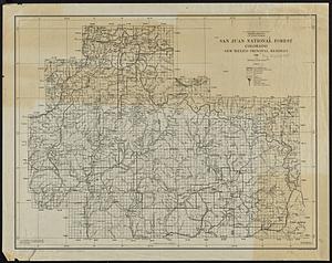
San Juan National Forest, Colorado
159.
Santa Barbara National Forest, California (Monterey Division)
160.
Saskatchewan : map showing disposition of lands
‹ Prev
Next ›
1
2
…
4
5
6
7
8
9
10


![Powdrell & Alexander, Inc. "Mill No. 3" (Connecticut Mills) (Cloth Working), Danielson, Conn. [insurance map]](https://bpldcassets.blob.core.windows.net/derivatives/images/commonwealth:2r36vc09s/image_thumbnail_300.jpg)