Toggle navigation
LMEC Home
Exhibitions
Georeferencing
Tools for Teachers
Collections
My Favorites
Sign Up / Log In
Search
Search the map portal
Map Collection
Map Collection
Map Sets
Search
Search
Search for
Search In
All Fields
Creator
Title
Subject
Place
Search All Digital Collections
Advanced Search
2843 Results
My Search
Start Over
atlas
Remove constraint atlas
Filter your Search
Place
North and Central America
1,647
United States
987
Europe
464
Massachusetts
348
Canada
271
Asia
190
South America
189
Suffolk (county)
163
more
Place
»
Topic
Landowners--Massachusetts--Boston--Maps
115
Real property--Massachusetts--Boston--Maps
106
United States--Maps
87
Boston (Mass.)--Maps
63
United States--History--French and Indian War, 1754-1763--Maps
63
Saint Lawrence River--Maps
41
Nautical charts--Early works to 1800
39
North America--Maps--Early works to 1800
36
more
Topic
»
Date
Date range begin
–
Date range end
Current results range from
1482
to
2023
View distribution
Creator
United States. Hydrographic Office
582
Des Barres, Joseph F. W. (Joseph Frederick Wallet), 1722-1824
118
Ptolemy, 2nd cent
100
Bromley, George Washington
99
Bromley, Walter Scott
97
G.W. Bromley & Co.
75
Carey, Mathew, 1760-1839
74
Paullin, Charles Oscar, 1868 or 1869-1944
70
more
Creator
»
Format
Maps/Atlases
2,827
Manuscripts
58
Books
37
Prints
8
Documents
5
Drawings/Illustrations
1
Georeferenced
Yes
142
No
2,701
Collection
Norman B. Leventhal Map & Education Center Collection
2,386
Maritime Charts and Atlases
1,150
American Revolutionary War-Era Maps
504
Boston and New England Maps
374
Urban Maps
250
Massachusetts Real Estate Atlases
144
William L. Clements Library Collection
92
Mapping Boston Collection
61
more
Collection
»
Available to use
No known restrictions
2,292
Creative Commons license
158
Search Constraints
Sort by relevance
relevance
title
date (asc)
date (desc)
Number of results to display per page
20 per page
10
per page
20
per page
50
per page
100
per page
View results as:
grid view
map view
Search Results
1001.
Behring's Sea and Arctic Ocean : from surveys of the U.S. North Pacific Surveying Expedition in 1855, Commander John Rodgers,...
1002.
Bermudas
1003.
The Bermudas, or Summer's Islands
1004.
Bigini or Pescadores Island ; Radogala and Korsakoff Islands
1005.
The Bosphorus : from French and British surveys in 1853, corrected to 1872
1006.
British Isles
1007.
Caldera Bay, west end of the island of Mindanao, Sooloo Sea
1008.
The Canary Islands : from British surveys in 1834 and 1838 corrected to 1871
1009.
Canary Islands, Tenerife, Santa Cruz
1010.
The Cape Verd Islands : laid down from the remarks and observations of experienced navigators
1011.
The Cape Verd Islands, laid down from the remarks and observations of experienced navigators
1012.
The Cape Verd Islands, laid down from the remarks and observations of experienced navigators
1013.
Cape Verde Islands, Porto Grande in the island of St. Vincent
1014.
Caribbean Sea, harbors etc. on the Mosquito coast : from British surveys corrected to 1872
1015.
Caribbean Sea--coast of Yucatan, special plans to chart no. 401 : from British surveys, corrected to 1872
1016.
Caribbean Sea--Gulf of Mexico, special plans to chart no. 404 : from British surveys, corrected to 1872
1017.
Caribbean Sea--western shore, special plans to chart no. 394 : from British surveys, corrected to 1872
1018.
Caribbean Sea--Yucatan, special plans to chart no. 401 : from British surveys, corrected to 1872
1019.
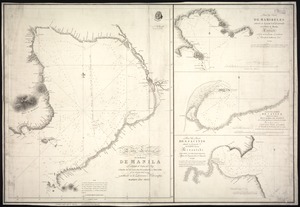
Carta esférica de la bahía de Manila trabajada de orden del Rey á borda de las corvetas descubierta y atrevída de la...
1020.
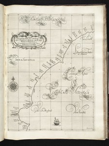
Carta particolare che comincia con il capo S. Andrea è finiscie con il capo Matas d'America
‹ Prev
Next ›
1
2
…
47
48
49
50
51
52
53
54
55
…
142
143