Toggle navigation
LMEC Home
Exhibitions
Georeferencing
Tools for Teachers
Collections
My Favorites
Sign Up / Log In
Search
Search the map portal
Map Collection
Map Collection
Map Sets
Search
Search
Search for
Search In
All Fields
Creator
Title
Subject
Place
Search All Digital Collections
Advanced Search
14021 Results
Filter your Search
Place
North and Central America
10,683
United States
8,692
Massachusetts
2,808
Suffolk (county)
1,682
Boston
1,638
Europe
1,420
Canada
1,009
New York
674
more
Place
»
Topic
Boston (Mass.)--Maps
748
City planning--Massachusetts--Boston--Maps
418
United States--History--Revolution, 1775-1783--Maps
331
United States--Maps
328
Real property--Massachusetts--Boston--Maps
254
Urban renewal--Massachusetts--Boston--Maps
254
North America--Maps--Early works to 1800
240
Massachusetts--Maps
234
more
Topic
»
Date
Date range begin
–
Date range end
Current results range from
1482
to
2023
View distribution
Creator
United States. Hydrographic Office
597
Boston Redevelopment Authority
404
Des Barres, Joseph F. W. (Joseph Frederick Wallet), 1722-1824
247
Jefferys, Thomas, -1771
172
Royal United Services Institute for Defence and Security Studies
160
George, III, King of Great Britain, 1738-1820
152
George, IV, King of Great Britain, 1762-1830
151
O.H. Bailey & Co
148
more
Creator
»
Format
Maps/Atlases
13,839
Manuscripts
985
Prints
102
Books
49
Drawings/Illustrations
44
Photographs
15
Objects/Artifacts
13
Documents
7
more
Format
»
Georeferenced
Yes
979
No
13,042
Collection
Norman B. Leventhal Map & Education Center Collection
9,110
American Revolutionary War-Era Maps
3,627
Boston and New England Maps
2,921
Urban Maps
2,480
Maritime Charts and Atlases
1,169
William L. Clements Library Collection
910
Library of Congress Collection
618
Boston Redevelopment Authority Collection
475
more
Collection
»
Available to use
No known restrictions
10,268
Creative Commons license
1,678
Search Constraints
Sort by relevance
relevance
title
date (asc)
date (desc)
Number of results to display per page
20 per page
10
per page
20
per page
50
per page
100
per page
View results as:
grid view
map view
Search Results
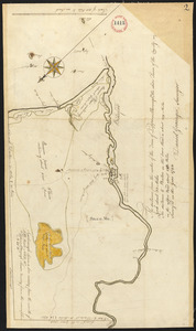
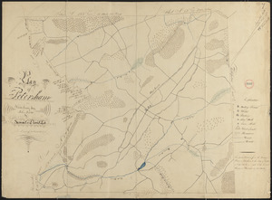
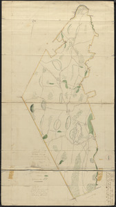
9841.
Plan of Pelham, surveyors' name not given, dated 1795.
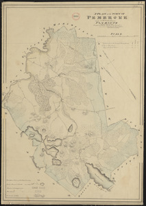
9842.
Plan of Pembroke made by John G. Hales, dated 1831
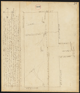
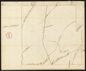
9843.
Plan of Pembroke, surveyor's name not given, dated 1794-5.
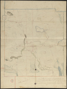
9844.
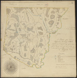
Plan of Penobscot surveyed by John Peters, dated 1794.
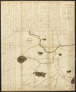
9845.
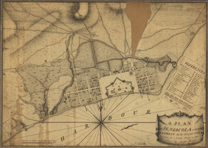
A plan of Pensacola and its environs in its present state : from an actual survey in 1778
9846.
Plan of Pepperell made by Caleb Butler, dated 1830
9847.
Plan of Pepperellborough (Saco) surveyed by Daniel Grainger, dated 1794.
9848.
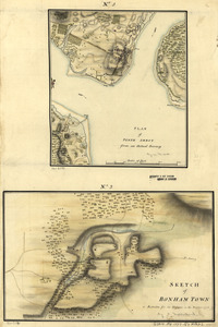
Plan of Perth Amboy from an actual survey. Sketch of Bonham Town
9849.
Plan of Peru (Partridgefield), surveyor's name not given, dated 1794-5.
9850.
Plan of Peru, surveyor's name not given, dated January 4, 1831
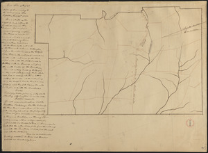
9851.
Plan of Petersham made by David Lee and Samuel Lee, dated November 30, 1830
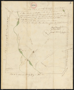
9852.
Plan of Petersham made by Jeremiah Robinson, dated May 1795.
9853.
Plan of Phillipston made by Jason Lamb, dated November 1830
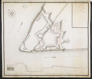
9854.
A Plan of Pitts Fort at Pittsburgh. Oct.r 1759
9855.
Plan of Pittsfield, surveyor's name not given, dated 1831
9856.
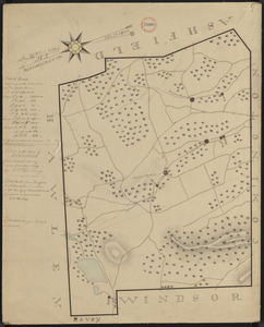
Plan of Pittsfield surveyor's name not given, dated December 8, 1794.
9857.
Plan of Plainfield District, surveyor's name not given, dated May 20, 1795.
9858.
Plan of Plainfield made by E. S. Darling, dated November, 1830
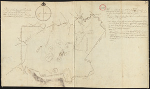
9859.
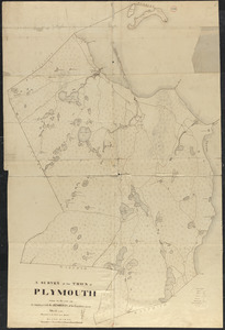
Plan of Plymouth made by S. Bourne, dated 1830
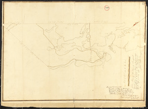
9860.
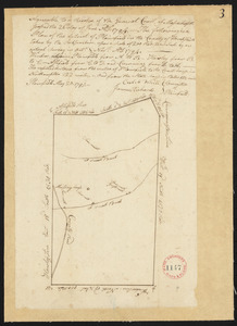
Plan of Plymouth, surveyor's name not given.
‹ Prev
Next ›
1
2
…
489
490
491
492
493
494
495
496
497
…
701
702