Toggle navigation
LMEC Home
Exhibitions
Georeferencing
Tools for Teachers
Collections
My Favorites
Sign Up / Log In
Search
Search the map portal
Map Collection
Map Collection
Map Sets
Search
Search
Search for
Search In
All Fields
Creator
Title
Subject
Place
Search All Digital Collections
Advanced Search
1084 Results
My Search
Start Over
Back Bay Boston
Remove constraint Back Bay Boston
Filter your Search
Place
North and Central America
833
United States
531
Massachusetts
238
Suffolk (county)
179
Boston
173
Canada
115
South America
62
Asia
61
more
Place
»
Topic
Boston (Mass.)--Maps
60
City planning--Massachusetts--Boston--Maps
48
Back Bay (Boston, Mass.)--Maps
47
North America--Maps--Early works to 1800
35
Landowners--Massachusetts--Boston--Maps
26
Real property--Massachusetts--Boston--Maps
26
New England--Maps--Early works to 1800
24
Nova Scotia--Maps--Early works to 1800
24
more
Topic
»
Date
Date range begin
–
Date range end
Current results range from
1565
to
2020
View distribution
Creator
United States. Hydrographic Office
277
Des Barres, Joseph F. W. (Joseph Frederick Wallet), 1722-1824
64
Boston Redevelopment Authority
36
Jefferys, Thomas, -1771
24
Sayer, Robert, 1725-1794
24
Franke, M. (Max)
23
U.S. Lake Survey
22
United States Exploring Expedition (1838-1842)
21
more
Creator
»
Format
Maps/Atlases
1,069
Manuscripts
69
Drawings/Illustrations
10
Objects/Artifacts
3
Prints
3
Books
1
Posters
1
Georeferenced
Yes
54
No
1,030
Collection
Norman B. Leventhal Map & Education Center Collection
945
Maritime Charts and Atlases
481
Boston and New England Maps
265
American Revolutionary War-Era Maps
231
Urban Maps
138
Boston Redevelopment Authority Collection
54
Mapping Boston Collection
40
Library of Congress Collection
35
more
Collection
»
Available to use
No known restrictions
946
Creative Commons license
112
Search Constraints
Sort by relevance
relevance
title
date (asc)
date (desc)
Number of results to display per page
20 per page
10
per page
20
per page
50
per page
100
per page
View results as:
grid view
map view
Search Results
881.
Townsend's Patent folding globe
882.
Tactical pilotage chart, TPC
883.
North Pacific islands
884.
La Nuoua Francia
885.
The coast of New England
886.
South America--west coast--Patagonia, anchorages in Wide Channel and Indian Reach : from Chilean partial surveys in 1879
887.
Fort William & Mary on Piscataqua River in the Province of New Hampshire on the Continent of America
888.
Joslin's hand-book to the terrestrial and celestial globes : how to use a globe
889.
China
890.
Domina Anglorum in America Septentrionali specialibus mappis Londini primum a Mollio edita, nunc recusa ab Homannianis Hered =...
891.
Greenville Mills, Inc., Greenville, N.H. [insurance map]
892.
The British possessions in North America from the best authorities
893.
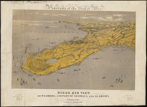
Birds eye view of Florida and part of Georgia and Alabama
894.
Birds eye view of North and South Carolina and part of Georgia
895.
Birds eye view of Virginia, Maryland, Delaware and the District of Columbia
896.
Strategic war points of the United States
897.
Nouvelle Hollande (à présent Nouvelle-York), Nouvelle-Angleterre, et une partie de la Virginie
898.
A new map of New England, New York, New Iarsey, Pensilvania, Maryland and Virginia
899.
Powdrell & Alexander, Inc. "Mill No. 3" (Connecticut Mills) (Cloth Working), Danielson, Conn. [insurance map]
900.
The game of American story and glory : [cards]
‹ Prev
Next ›
1
2
…
41
42
43
44
45
46
47
48
49
…
54
55


![Greenville Mills, Inc., Greenville, N.H. [insurance map]](https://bpldcassets.blob.core.windows.net/derivatives/images/commonwealth:ww72c036z/image_thumbnail_300.jpg)


![Powdrell & Alexander, Inc. "Mill No. 3" (Connecticut Mills) (Cloth Working), Danielson, Conn. [insurance map]](https://bpldcassets.blob.core.windows.net/derivatives/images/commonwealth:2r36vc09s/image_thumbnail_300.jpg)