Toggle navigation
LMEC Home
Exhibitions
Georeferencing
Tools for Teachers
Collections
My Favorites
Sign Up / Log In
Search
Search the map portal
Map Collection
Map Collection
Map Sets
Search
Search
Search for
Search In
All Fields
Creator
Title
Subject
Place
Search All Digital Collections
Advanced Search
2261 Results
My Search
Start Over
london
Remove constraint london
Filter your Search
Place
North and Central America
1,492
United States
943
Europe
363
Canada
347
North America
194
New York
129
Massachusetts
117
New England
104
more
Place
»
Topic
North America--Maps--Early works to 1800
137
Coasts--Nova Scotia--Maps
64
New England--Maps--Early works to 1800
57
United States--History--French and Indian War, 1754-1763--Maps
57
United States--History--French and Indian War, 1754-1763--Maps, Manuscript--Early works to 1800
56
United States--Maps--Early works to 1800
54
United States--History--Revolution, 1775-1783--Maps
40
Nova Scotia--Maps--Early works to 1800
39
more
Topic
»
Date
Date range begin
–
Date range end
Current results range from
1624
to
1999
View distribution
Creator
Des Barres, Joseph F. W. (Joseph Frederick Wallet), 1722-1824
242
Jefferys, Thomas, -1771
167
George, III, King of Great Britain, 1738-1820
149
George, IV, King of Great Britain, 1762-1830
148
Sayer, Robert, 1725-1794
115
Faden, William, 1749-1836
109
Moll, Herman, d. 1732
72
Robert Sayer and John Bennett (Firm)
57
more
Creator
»
Format
Maps/Atlases
2,219
Manuscripts
161
Prints
23
Drawings/Illustrations
15
Books
4
Objects/Artifacts
1
Georeferenced
Yes
137
No
2,124
Collection
American Revolutionary War-Era Maps
1,355
Norman B. Leventhal Map & Education Center Collection
1,305
Maritime Charts and Atlases
263
British Library Collection
163
William L. Clements Library Collection
160
Boston and New England Maps
152
Richard H. Brown Revolutionary War Map Collection at Mount Vernon
146
MacLean Collection Map Library
140
more
Collection
»
Available to use
No known restrictions
1,271
Creative Commons license
569
Search Constraints
Sort by relevance
relevance
title
date (asc)
date (desc)
Number of results to display per page
20 per page
10
per page
20
per page
50
per page
100
per page
View results as:
grid view
map view
Search Results
841.
Curaçao
842.
New Found Land, St. Laurence Bay, the fishing banks, Acadia, and part of New Scotland
843.
A chart of the South Sea
844.
The coast of Nova Scotia, New England, New-York, Jersey, the Gulph and River of St. Lawrence : the islands of Newfoundland,...
845.
The island of Barbadoes : divided into its parishes, with the roads, paths, &c. according to an actual and accurate survey
846.
The island of St. Christophers, alias St. Kitts
847.
A map of Virginia and Maryland
848.
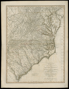
The marches of Lord Cornwallis in the Southern Provinces, now states of North America : comprehending the two Carolinas, with...
849.
A New and correct map of the British colonies in North America comprehending eastern Canada with the province of Quebec, New...
850.
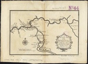
A particular map of the River Sanaga, from ye desart, to ye Isle of Morfil or Jvory, including the Lake of Pania Fuli
851.
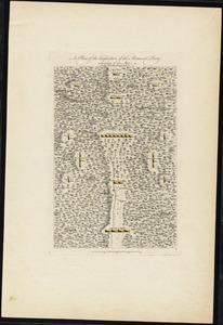
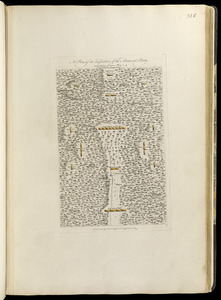
A plan of the disposition of the advanced party consisting of 400 men : to defend the workers in making the road
852.
A plan of the disposition of the advanced party consisting of 400 men : to defend the workers in making the road
853.
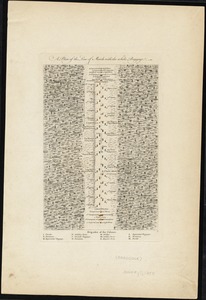
A plan of the line of march with the whole baggage
854.
A plan of the line of march with the whole baggage
855.
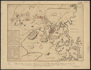
A plan of the town and harbour of Boston, and the country adjacent with the road from Boston to Concord shewing the place of...
856.
The Seat of war, in New England
857.
Tobago
858.
White Islands Harbour : Port Stephen's ; Liscomb Harbour ; Houlton Harbour ; River St. Mary
859.
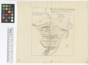
Battle of Guildford fought on the 15 of March 1781
860.
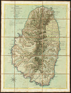
Isle St. Vincent
‹ Prev
Next ›
1
2
…
39
40
41
42
43
44
45
46
47
…
113
114