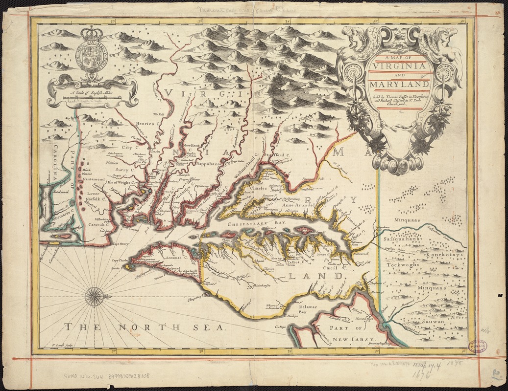
A map of Virginia and Maryland
Item Information
- Title:
- A map of Virginia and Maryland
- Creator:
- Speed, John, 1552?-1629
- Date:
-
[1676]
- Format:
-
Maps/Atlases
- Location:
-
Boston Public Library
Norman B. Leventhal Map & Education Center - Collection (local):
-
Norman B. Leventhal Map & Education Center Collection
- Subjects:
-
Virginia--Maps--Early works to 1800
Maryland--Maps--Early works to 1800
- Places:
-
Virginia
Maryland
- Extent:
- 1 map ; 36 x 48 cm.
- Terms of Use:
-
No known copyright restrictions.
No known restrictions on use.
- Publisher:
-
[London] :
Sold by Thomas Basset in Fleet Street and Richard Chiswell in St. Pauls Church yard
- Scale:
-
Scale 1:1,150,000.
- Language:
-
English
- Notes:
-
Relief shown pictorially.
Verso: The description of Mary-Land, p. 44; The description of Virginia, p. 43.
From: Speed, John. A prospect of the most famous parts of the world. London. 1676.
Engraved by: F. Lamb.
Derived from Augustine Herrman map of 1673.
- Notes (date):
-
This date is inferred.
- Identifier:
-
06_01_006783
- Call #:
-
G3790 1676 .S64
- Barcode:
-
39999059028108


