Toggle navigation
LMEC Home
Exhibitions
Georeferencing
Tools for Teachers
Collections
My Favorites
Sign Up / Log In
Search
Search the map portal
Map Collection
Map Collection
Map Sets
Search
Search
Search for
Search In
All Fields
Creator
Title
Subject
Place
Search All Digital Collections
Advanced Search
213 Results
My Search
Start Over
Date
1920
to
1924
Remove constraint Date: <span class='from'>1920</span> to <span class='to'>1924</span>
Filter your Search
Place
North and Central America
168
United States
151
Massachusetts
35
Europe
23
Boston
22
Suffolk (county)
22
Canada
13
Bristol (county)
12
more
Place
»
Topic
Fire risk assessment
32
Insurance surveys
32
Textile factories
23
Cotton manufacture
17
Boston (Mass.)--Maps
11
Europe--Maps
6
Longmeadow (Mass.)--Maps
5
Real property--Massachusetts--Boston--Maps
5
more
Topic
»
Date
1920
to
1924
[remove]
213
Date range begin
–
Date range end
Current results range from
1770
to
1999
1920
to
1920
74
1921
to
1921
62
1922
to
1922
58
1923
to
1923
41
1924
to
1924
59
Creator
Associated Mutual Insurance Companies
23
Geological Survey (U.S.)
12
Richards Map Company
9
Rand McNally and Company
8
United States. Army. Engineer Reproduction Plant
7
Associated Factory Mutual Fire Insurance Companies
5
France. Armée. Groupe de canevas de tir
5
Price & Lee Co.
5
more
Creator
»
Format
Maps/Atlases
212
Photographs
1
Georeferenced
Yes
16
No
197
Collection
Norman B. Leventhal Map & Education Center Collection
166
American Textile History Museum Image Collection
32
Boston and New England Maps
18
Urban Maps
17
Massachusetts Real Estate Atlases
8
Lucius Beebe Memorial Library Historic Maps
3
American Revolutionary War-Era Maps
1
Boston Redevelopment Authority Collection
1
more
Collection
»
Available to use
No known restrictions
170
Creative Commons license
1
Search Constraints
Sort by relevance
relevance
title
date (asc)
date (desc)
Number of results to display per page
20 per page
10
per page
20
per page
50
per page
100
per page
View results as:
grid view
map view
Search Results
61.
The great north woods tourist and fishing district of Wisconsin : ideal location for summer homes
62.
Greater Macon
63.
Hammond's enlarged map of Europe of to-day showing boundaries of the new states as determined by the peace conference
64.
Hoosac Cotton Mills "Nos. 1 & 2 Mills," North Adams, Mass. [insurance map]
65.
Hudson's map of Minneapolis
66.
Hyde Park
67.
Indexed guide map of the city of Vancouver and suburbs
68.
The Indian Empire and Ceylon
69.
Kootenai National Forest, Montana
70.
Landing facilities and proposed airway system in the United States, 1923
71.
Landing facilities and proposed airway system in the United States, 1924
72.
London Midland and Scottish Railway
73.
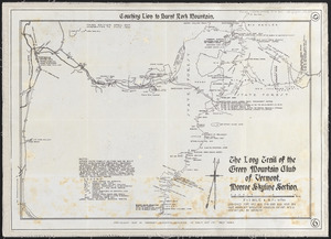
The Long Trail of the Green Mountain Club of Vermont : Monroe Skyline section : Glen Ellen to Lincoln-Warren Pass
74.
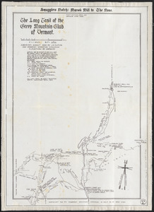
The Long Trail of the Green Mountain Club of Vermont : Smuggler's Notch: Morse's Mill to the Nose
75.
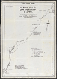
The Long Trail of the Green Mountain Club of Vermont : Trout Club to Bolton
76.
The Long Trail of the Green Mountain Club of Vermont : Monroe Skyline section: Couching Lion to Burnt Rock Mountain
77.
Lorraine Mfg. Co. (Cotton & Worsted Mill), Pawtucket, R.I. [insurance map]
78.
Lovell's map of the city of Montreal : including Westmount, Outremount, Verdun, Montreal West and St. Laurent
79.
Manitoba : map showing disposition of lands
80.
Manomet Mills "Mill No. 4" (Cotton Mill), New Bedford, Mass.
‹ Prev
Next ›
1
2
3
4
5
6
7
8
…
10
11


![Hoosac Cotton Mills "Nos. 1 & 2 Mills," North Adams, Mass. [insurance map]](https://bpldcassets.blob.core.windows.net/derivatives/images/commonwealth:2r36vc60r/image_thumbnail_300.jpg)


![Lorraine Mfg. Co. (Cotton & Worsted Mill), Pawtucket, R.I. [insurance map]](https://bpldcassets.blob.core.windows.net/derivatives/images/commonwealth:2r36vc298/image_thumbnail_300.jpg)