Toggle navigation
LMEC Home
Exhibitions
Georeferencing
Tools for Teachers
Collections
My Favorites
Sign Up / Log In
Search
Search the map portal
Map Collection
Map Collection
Map Sets
Search
Search
Search for
Search In
All Fields
Creator
Title
Subject
Place
Search All Digital Collections
Advanced Search
79 Results
My Search
Start Over
Date
1902
Remove constraint Date: <span class='single'>1902</span>
Filter your Search
Place
North and Central America
63
United States
40
Massachusetts
17
Boston
12
Suffolk (county)
12
Canada
8
Cuba
7
Halifax Regional Municipality
6
more
Place
»
Topic
Boston (Mass.)--Maps
7
Geology--Nova Scotia--Halifax (County)--Maps
6
Gold mines and mining--Nova Scotia--Maps
6
Halifax (N.S. : County)--Maps
6
Mines and mineral resources--Nova Scotia--Halifax (County)--Maps
6
Cárdenas Bay (Cuba)--Maps
3
Massachusetts--Maps
3
New England--Maps--Early works to 1800--Facsimiles
3
more
Topic
»
Date
1902
[remove]
79
Date range begin
–
Date range end
Current results range from
1770
to
1999
1902
to
1902
79
Creator
United States. Army. Department of Cuba
7
United States. Congress (56th, 2nd session : 1900-1901). House
7
United States. Government Printing Office
7
United States. War Department
7
Geological Survey of Canada
6
National Publishing Company (Boston, Mass.)
5
Canada. Department of the Interior
3
Blanchard, Rufus, 1821-1904
2
more
Creator
»
Format
Maps/Atlases
77
Photographs
1
Prints
1
Georeferenced
Yes
11
No
68
Collection
Norman B. Leventhal Map & Education Center Collection
74
Boston and New England Maps
4
Urban Maps
4
Robert E. Diefenbach Map Collection at Phillips Academy
3
American Revolutionary War-Era Maps
1
Massachusetts Real Estate Atlases
1
Sidney R. Knafel Map Collection at Phillips Academy
1
Available to use
No known restrictions
77
Search Constraints
Sort by relevance
relevance
title
date (asc)
date (desc)
Number of results to display per page
20 per page
10
per page
20
per page
50
per page
100
per page
View results as:
grid view
map view
Search Results
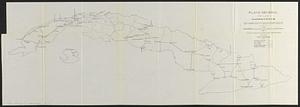
61.
Plano general de las carreteras que merecen atencion preferente
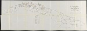
62.
Plano general de los ferrocarriles de la Isla de Cuba
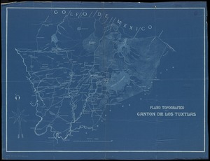
63.
Plano topografico del canton de Los Tuxtlas
64.
Porto-Rico showing road work, light houses, rail roads, towns and coast line
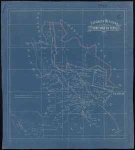
65.
República Mexicana, Territorio de Tepic
66.
Samuel Thaxter & Son, manufacturers and importers of nautical and optical instruments, charts and nautical books; publishers of...
67.
A small map of the sea coast of New England together with the outlines of several of the provinces lying thereon, 1738
68.
The south part of New-England, as it is planted this yeare, 1635
69.
State of Chiapas
70.
State of Oaxaca
71.
To his excellency William Shirley Esqr., Captain General and Commander in Chief, in and over his Majesty's province of the...
72.
Topographical map of the Rocky Mountains : Lake Louise sheet
73.
Topographical map of the Rocky Mountains : Banff sheet
74.
Touring road map of Chicago and environs : 6 counties
75.
Tourist's map of Scotland : reduced by permission from the Ordnance Survey by John Bartholomew, F.R.G.S.
76.
Town of Nahant
77.
The United States of America : including all its newly acquired territory
78.
Victoria
79.
Western part of the United States of America including all its newly acquired territory
‹ Prev
Next ›
1
2
3
4