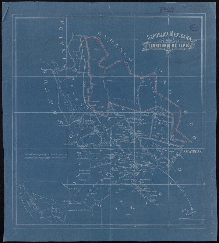
República Mexicana, Territorio de Tepic
Item Information
- Title:
- República Mexicana, Territorio de Tepic
- Title (alt.):
-
Territorio de Tepic
- Date:
-
[1900–1914]
- Format:
-
Maps/Atlases
- Location:
-
Boston Public Library
Norman B. Leventhal Map & Education Center - Collection (local):
-
Norman B. Leventhal Map & Education Center Collection
- Subjects:
-
Nayarit (Mexico)--Maps
- Places:
-
MexicoNayarit
- Extent:
- 1 map ; 46 x 41 cm
- Terms of Use:
-
No known copyright restrictions.
No known restrictions on use.
- Publisher:
-
[Place of publication not identified] :
[publisher not identified]
- Scale:
-
Scale 1:690,000
- Language:
-
Spanish
- Notes:
-
Blueprint.
Prime meridian: Mexico City.
Inset: [Location map].
Also indicates lands of the Arellano and Gayon companies.
Northeast section outlined in red pencil and annotated in pen: Concession land to Luis Gayon y Sacion.
- Notes (date):
-
This date is inferred.
- Identifier:
-
06_01_011781
- Call #:
-
G4660 1914 .R47
- Barcode:
-
39999065689174