Toggle navigation
LMEC Home
Exhibitions
Georeferencing
Tools for Teachers
Collections
My Favorites
Sign Up / Log In
Search
Search the map portal
Map Collection
Map Collection
Map Sets
Search
Search
Search for
Search In
All Fields
Creator
Title
Subject
Place
Search All Digital Collections
Advanced Search
148 Results
My Search
Start Over
1918
Remove constraint 1918
Filter your Search
Place
Europe
83
North and Central America
40
United States
36
France
27
Asia
16
Balkan Peninsula
12
Belgium
10
Africa
7
more
Place
»
Topic
Europe--Maps
17
France--Maps
17
World War, 1914-1918--Europe--Maps
11
World War, 1914-1918--Maps
10
Balkan Peninsula--Maps
9
Belgium--Maps
9
Long Trail (Vt.)--Maps
7
Trails--Vermont--Maps
7
more
Topic
»
Date
Date range begin
–
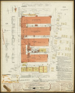
Date range end
Current results range from
1831
to
1934
View distribution
Creator
American Geographical Society of New York
32
Gross, Alexander, 1879-1958
28
Congdon, Herbert Wheaton, 1876-1965
7
Army Service Schools (U.S.)
5
C.S. Hammond & Company
5
France. Armée. Groupe de canevas de tir
5
United States. Army. Army, 2nd
5
United States. Army. Engineer Reproduction Plant
5
more
Creator
»
Format
Maps/Atlases
148
Georeferenced
Yes
15
No
133
Collection
Norman B. Leventhal Map & Education Center Collection
142
Boston and New England Maps
5
Urban Maps
5
American Textile History Museum Image Collection
3
Massachusetts Real Estate Atlases
2
Town plans, 1830
1
Available to use
No known restrictions
143
Search Constraints
Sort by relevance
relevance
title
date (asc)
date (desc)
Number of results to display per page
20 per page
10
per page
20
per page
50
per page
100
per page
View results as:
grid view
map view
Search Results
61.
Europe showing the proposed new states
62.
The Daily Telegraph gazetteer war map (no. 4)
63.
Guerre d'orient, Balkans, Asie Mineure, Perse
64.
Schaap-balie
65.
St. Mihiel - B
66.
The Daily Telegraph war map no. 20
67.
Financial irrigation of the United States by funds appropriated for emergency use under the New Deal
68.
Transylvania campaigne Oct. 1916 ; Macedonian campaigne ; Somme Campaigne Oct. 1916
69.
Mapa del estado de Durango, Republica Mexicana
70.
Gallatin National Forest, Montana
71.
Military map of the United States of America showing location of all forces in training
72.
Map of the Yougoslav countries
73.
Lyman Mills (Cotton Mill), Holyoke, Mass. [insurance map]
74.
Bird's-eye view of Boston, showing the burned district
75.
Bird's-eye view of New York City
76.
General unsicht von Boston and der Bogelschau mit Bezeichnung des abgebrannten Stadttheiles : = Bird's eye view of Boston,...
77.
Map of the Jesuit missions in Huronia
78.
Passaic Cotton Mills "Rotch Dept." & "Penrod Dept.", New Bedford, Mass.
79.
Bird's-eye view of Boston, showing the burned district
80.
Eastern Manufacturing Company (Paper Mill), South Brewer, Me. [insurance map]
‹ Prev
Next ›
1
2
3
4
5
6
7
8


![Lyman Mills (Cotton Mill), Holyoke, Mass. [insurance map]](https://bpldcassets.blob.core.windows.net/derivatives/images/commonwealth:2r36vc50h/image_thumbnail_300.jpg)


![Eastern Manufacturing Company (Paper Mill), South Brewer, Me. [insurance map]](https://bpldcassets.blob.core.windows.net/derivatives/images/commonwealth:ww72bx30q/image_thumbnail_300.jpg)