Toggle navigation
LMEC Home
Exhibitions
Georeferencing
Tools for Teachers
Collections
My Favorites
Sign Up / Log In
Search
Search the map portal
Map Collection
Map Collection
Map Sets
Search
Search
Search for
Search In
All Fields
Creator
Title
Subject
Place
Search All Digital Collections
Advanced Search
14020 Results
Filter your Search
Place
North and Central America
10,683
United States
8,692
Massachusetts
2,808
Suffolk (county)
1,682
Boston
1,638
Europe
1,420
Canada
1,009
New York
674
more
Place
»
Topic
Boston (Mass.)--Maps
748
City planning--Massachusetts--Boston--Maps
418
United States--History--Revolution, 1775-1783--Maps
331
United States--Maps
328
Real property--Massachusetts--Boston--Maps
254
Urban renewal--Massachusetts--Boston--Maps
254
North America--Maps--Early works to 1800
240
Massachusetts--Maps
234
more
Topic
»
Date
Date range begin
–
Date range end
Current results range from
1482
to
2023
View distribution
Creator
United States. Hydrographic Office
597
Boston Redevelopment Authority
404
Des Barres, Joseph F. W. (Joseph Frederick Wallet), 1722-1824
247
Jefferys, Thomas, -1771
172
Royal United Services Institute for Defence and Security Studies
160
George, III, King of Great Britain, 1738-1820
152
George, IV, King of Great Britain, 1762-1830
151
O.H. Bailey & Co
148
more
Creator
»
Format
Maps/Atlases
13,838
Manuscripts
985
Prints
102
Books
49
Drawings/Illustrations
44
Photographs
15
Objects/Artifacts
13
Documents
7
more
Format
»
Georeferenced
Yes
979
No
13,041
Collection
Norman B. Leventhal Map & Education Center Collection
9,109
American Revolutionary War-Era Maps
3,627
Boston and New England Maps
2,921
Urban Maps
2,479
Maritime Charts and Atlases
1,169
William L. Clements Library Collection
910
Library of Congress Collection
618
Boston Redevelopment Authority Collection
475
more
Collection
»
Available to use
No known restrictions
10,267
Creative Commons license
1,678
Search Constraints
Sort by relevance
relevance
title
date (asc)
date (desc)
Number of results to display per page
20 per page
10
per page
20
per page
50
per page
100
per page
View results as:
grid view
map view
Search Results
6601.
Map showing Japanese-Chinese warfre [sic] now in Shanghai
6602.
[Map showing Jonathan Carver's travels west of the Great Lakes.]
6603.
[Map showing Jonathan Carver's travels west of the Great Lakes.]
6604.
Map showing land grants to the east of St. John
6605.
Map showing lines of the Bell telephone companies in the United States and Canada : July 1st, 1904
6606.
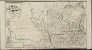
Map showing location of the Chicago & Northwestern Railway with its branches & connections through Illinois, Iowa, Nebraska,...
6607.
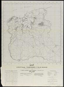
Map showing locations of temporary field works erected by the Spanish for the land defense of Havana, 1897-1898
6608.
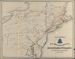
Map showing long distance telephone lines and metallic circuit connections
6609.
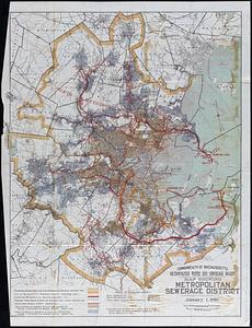
Map showing Metropolitan Sewerage District : January 1, 1921
6610.
Map showing metropolitan sewerage district : January 1, 1910
6611.
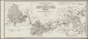
Map showing metropolitan water district, Wachusett, Sudbury and Cochituate watersheds and locations of reservoirs, aqueducts...
6612.
[Map showing military locations from Fort Cumberland on the River Potomac to Fort Presqu'Isle on Lake Erie]
6613.
[Map showing military locations from Fort Cumberland on the River Potomac to Fort Presqu'Isle on Lake Erie]
6614.
Map showing mounted police stations in north-western Canada
6615.
Map showing mounted police stations in the North West Territories
6616.
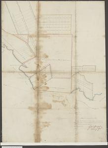
[Map showing neck of land between 'Baye francaise' and 'Baye verte']
6617.
[Map showing operations against Philadelphia by the British in November 1777]
6618.
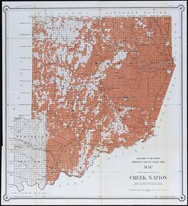
Map showing progress of allotment in Creek Nation
6619.
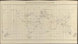
Map showing recorded dates of influenza epidemic in 1889 and 1890
6620.
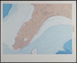
Map showing relation of land and submarine topography, Nova Scotia to Florida
‹ Prev
Next ›
1
2
…
327
328
329
330
331
332
333
334
335
…
700
701
![Map showing Japanese-Chinese warfre [sic] now in Shanghai](https://bpldcassets.blob.core.windows.net/derivatives/images/commonwealth:9s161h819/image_thumbnail_300.jpg)
![[Map showing Jonathan Carver's travels west of the Great Lakes.]](https://bpldcassets.blob.core.windows.net/derivatives/images/commonwealth:hx11z299h/image_thumbnail_300.jpg)
![[Map showing Jonathan Carver's travels west of the Great Lakes.]](https://bpldcassets.blob.core.windows.net/derivatives/images/commonwealth:6108vw266/image_thumbnail_300.jpg)


![[Map showing military locations from Fort Cumberland on the River Potomac to Fort Presqu'Isle on Lake Erie]](https://bpldcassets.blob.core.windows.net/derivatives/images/commonwealth:hx11z2367/image_thumbnail_300.jpg)
![[Map showing military locations from Fort Cumberland on the River Potomac to Fort Presqu'Isle on Lake Erie]](https://bpldcassets.blob.core.windows.net/derivatives/images/commonwealth:hx11z2324/image_thumbnail_300.jpg)
![[Map showing neck of land between 'Baye francaise' and 'Baye verte']](https://bpldcassets.blob.core.windows.net/derivatives/images/commonwealth:hx11z035j/image_thumbnail_300.jpg)
![[Map showing operations against Philadelphia by the British in November 1777]](https://bpldcassets.blob.core.windows.net/derivatives/images/commonwealth:6108vv61k/image_thumbnail_300.jpg)