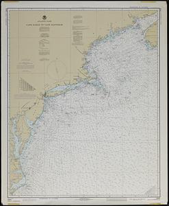
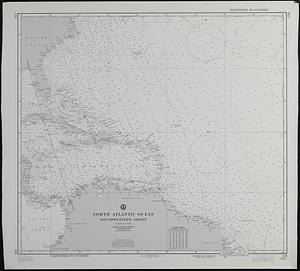
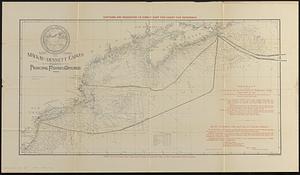
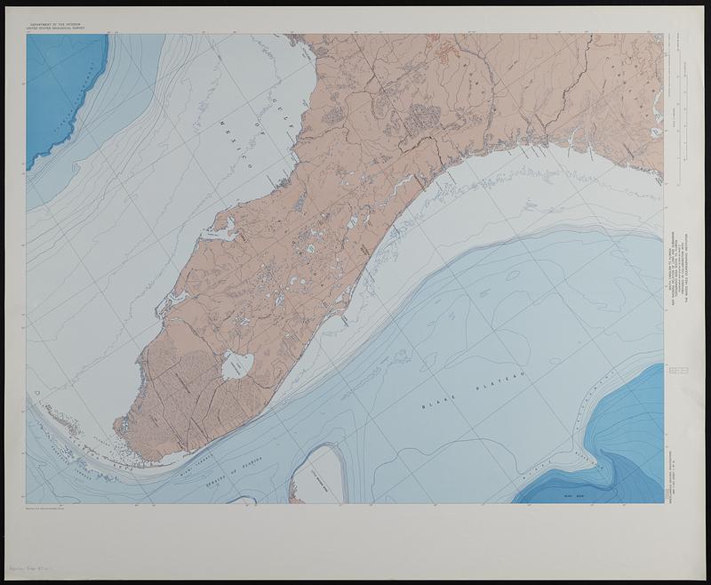
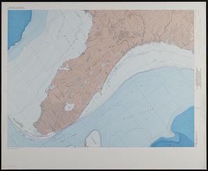
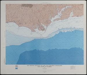
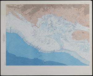
Map showing relation of land and submarine topography, Nova Scotia to Florida
Item Information
- Title:
- Map showing relation of land and submarine topography, Nova Scotia to Florida
- Cartographer:
- Uchupi, Elazar
- Contributor:
- Woods Hole Oceanographic Institution
- Name on Item:
-
by Elazar Uchupi ; prepared in collaboration with the Woods Hole Oceanographic Institution
- Date:
-
1965
- Format:
-
Maps/Atlases
- Genre:
-
Bathymetric maps
Physical maps
- Location:
-
Boston Public Library
Norman B. Leventhal Map & Education Center - Collection (local):
-
Applied Geographics, Inc. Records
- Subjects:
-
Atlantic Coast (U.S.)--Maps
Continental shelf--Atlantic Coast (U.S.)--Maps
Submarine topography--Atlantic Coast (U.S.)--Maps
- Places:
-
Eastern United States (area)
- Extent:
- 1 map on 3 sheets : color ; 70 x 280 cm, sheets 85 x 104 cm, folded in envelope 31 x 24 cm
- Terms of Use:
-
No known copyright restrictions.
No known restrictions on use.
- Publisher:
-
Washington, D.C. :
Interior--Geological Survey
- Scale:
-
Scale 1:1,000,000
- Projection:
- Lambert conformal conic projection
- Language:
-
English
- Table of Contents:
-
South Carolina to Florida
New Jersey to South Carolina
Nova Scotia to New Jersey.
- Notes:
-
Relief shown by contours, gradient tints, and spot heights. Depths shown by contours and gradient tints.
Oriented with north to the upper right.
Includes layout diagram.
"G65040."
- Identifier:
-
06_01_019114
- Call #:
-
AppGeo Folder 37 no.2-4