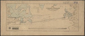
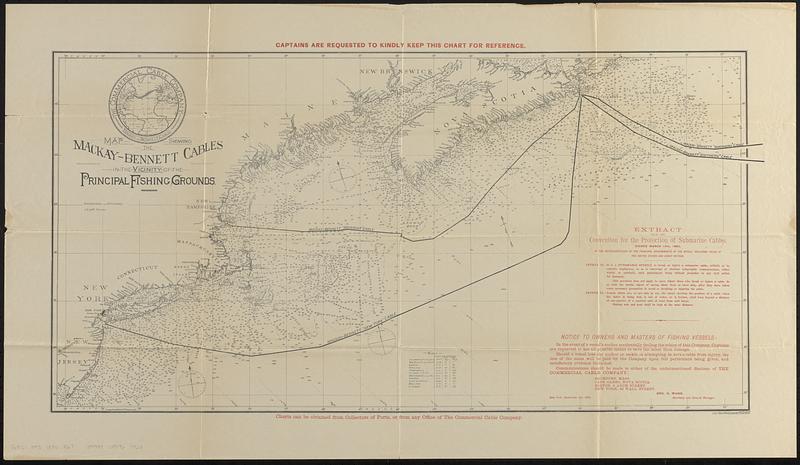
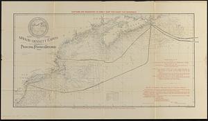
Map showing the Mackay-Bennett cables in the vicinity of the principal fishing grounds
Item Information
- Title:
- Map showing the Mackay-Bennett cables in the vicinity of the principal fishing grounds
- Title (alt.):
-
Chart showing the position of the Mackay-Bennett cables in the vicinity of the principal fishing grounds
- Cartographer:
- Rosenberg, Leo von
- Publisher:
- Commercial Cable Company
- Name on Item:
-
Leo von Rosenberg
- Date:
-
1886
- Format:
-
Maps/Atlases
- Genre:
-
Nautical charts
- Location:
-
Boston Public Library
Norman B. Leventhal Map & Education Center - Collection (local):
-
Norman B. Leventhal Map & Education Center Collection
- Subjects:
-
Atlantic Coast (U.S.)--Maps
Atlantic Coast (Canada)--Maps
North Atlantic Ocean--Maps
Navigation--North Atlantic Ocean
Transatlantic cables--Maps
Commercial Cable Company
- Places:
-
CanadaMaritime Provinces (area)
New England (area)
- Extent:
- 1 map : color ; 38 x 77 cm, folded in envelope 23 x 14 cm
- Terms of Use:
-
No known copyright restrictions.
No known restrictions on use.
- Publisher:
-
New York :
Commercial Cable Company
- Scale:
-
Scale approximately 1:2,150,000
- Language:
-
English
- Notes:
-
Nautical chart of the Atlantic coast of northeastern United States and southeastern Canada, showing Transatlantic telegraph cables operated by the Commercial Cable Company, for distribution to fishing vessels.
Relief shown by soundings and isolines.
Includes Extract from the Convention for the Protection of Submarine Cables, Notice to owners and masters of fishing vessels, tide table, and inset map showing the company's transatlantic cables.
- Identifier:
-
06_01_018483
- Call #:
-
G9101.P93 1886 .R67
- Barcode:
-
39999085967923