Toggle navigation
LMEC Home
Exhibitions
Georeferencing
Tools for Teachers
Collections
My Favorites
Sign Up / Log In
Search
Search the map portal
Map Collection
Map Collection
Map Sets
Search
Search
Search for
Search In
All Fields
Creator
Title
Subject
Place
Search All Digital Collections
Advanced Search
56 Results
My Search
Start Over
g3201
Remove constraint g3201
Filter your Search
Place
World
53
Germany
2
Topic
World maps
36
Pictorial maps
8
Telegraph lines--Maps
8
Map projection
3
Telecommunication--Maps
3
Trade routes--Maps
3
World War, 1939-1945--Maps
3
World maps--Early works to 1800
3
more
Topic
»
Date
Date range begin
–
Date range end
Current results range from
1668
to
2006
View distribution
Creator
Chase, Ernest Dudley, 1878-
6
International Telegraph Bureau (Bern, Switzerland)
4
ODT, Inc
3
Chase, Ernest Dudley, 1878-1966
2
United States. Hydrographic Office
2
Van Hoven, C.
2
Whiting, Oliver K.
2
Abizaid, John George, 1868-
1
more
Creator
»
Format
Maps/Atlases
55
Objects/Artifacts
1
Prints
1
Georeferenced
Yes
2
No
54
Collection
Norman B. Leventhal Map Center Collection
56
American Revolutionary War-Era Maps
2
Available to use
No known restrictions
53
Search Constraints
Sort by title
relevance
title
date (asc)
date (desc)
Number of results to display per page
20 per page
10
per page
20
per page
50
per page
100
per page
View results as:
grid view
map view
Search Results
41.
Racing routes of the Yankee clippers
42.
Reg Manning's table-top argu-map of the world
43.
The story map of flying : being a chronicle of man's conquest of the air
44.
Submarine cable chart of the world : showing also the seacoast stations and the principal connecting land lines ; for the use...
45.
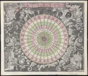
Systema ideale quo exprimitur, aquarum per canales hydragogos subterraneos ex mari et in montium hydrophylacia protrusio,...
46.
Tabula anemographica seu pyxis nautica vulgo compass charte : quâ ventorum noia septem linguis græca scil. latina, italica,...
47.
Total war battle map
48.
Track chart U.S. dry dock Dewey : Solomons to Olongapo, December 28, 1905-July 10, 1906
49.
Welt-karte zur übersicht der meeres-strömungen und des schnellverkehrs
50.
Wereldkaart "reis om de wereld"
51.
The World
52.
World freedom : a factual & pictorial map
53.
World map of the major tropical diseases
54.
The world, on Mercator's projection : showing the different routes to California, and distance by each; routes of different...
55.
World wonders : a pictorial map
56.
The world's most populous countries
‹ Prev
Next ›
1
2
3


![Systema ideale quo exprimitur, aquarum per canales hydragogos subterraneos ex mari et in montium hydrophylacia protrusio, aquarumq[ue] subterrestrium per pyragogos canales concoctus](https://bpldcassets.blob.core.windows.net/derivatives/images/commonwealth:n8710p89m/image_thumbnail_300.jpg)