Tabula anemographica seu pyxis nautica vulgo compass charte : quâ ventorum noia septem linguis græca scil. latina, italica, hispanica, gallica, hollandica et germanica repræsentantur succinctè elaborata
Item Information
- Title:
- Tabula anemographica seu pyxis nautica vulgo compass charte : quâ ventorum noia septem linguis græca scil. latina, italica, hispanica, gallica, hollandica et germanica repræsentantur succinctè elaborata
- Description:
-
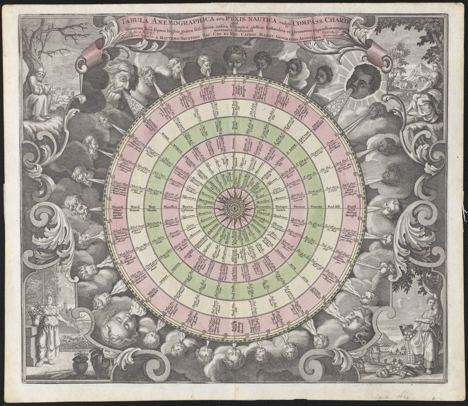
Regions & Seasons: Thirty-two wind heads appear on this 1760 chart of the heavens by German mapmaker Matthaeus Seutter. Corresponding with each of the thirty-two points on the compass, these winds range in age from young to old, with the largest wind heads representing the four principal winds Boreas (North), Eurus (East), Notus (South) and Zephyrus (West). Figures representing the four seasons appear in each corner of the map, and their placement near the four groups of winds symbolizes the weather and natural phenomena each wind was said to bring.
- Creator:
- Seutter, Matthaeus, 1678-1756
- Cartographer:
- Seutter, Matthaeus, 1678-1756
- Name on Item:
-
â Matthæo Seuttero, sac. cæs. et reg. cathol. majest. geographo augustano
- Date:
-
[ca. 1740]
- Format:
-
Prints
- Location:
-
Boston Public Library
Norman B. Leventhal Map & Education Center - Collection (local):
-
Norman B. Leventhal Map & Education Center Collection
- Subjects:
-
Cardinal points--Early works to 1800
Winds--Pictorial works--Early works to 1800
- Extent:
- 1 picture : color ; 50 x 58 cm
- Terms of Use:
-
No known copyright restrictions.
No known restrictions on use.
- Publisher:
-
[Augsburg] :
Matthaeo Seuttero
- Language:
-
Latin
- Notes:
-
Wind chart showing the compass disc divided in 32 sections, with text in seven languages (Greek, Latin, Italian, Spanish, French, Dutch and German). Surrounding the compass are 31 small cherub heads arranged in successive ages from young to old, and four large heads, blowing winds on the compass and seasons. The corners are decorated with large allegorical representations of the four seasons.
- Notes (exhibitions):
-
Exhibited: "Regions and Seasons: Mapping Climate through History" organized by the Norman B. Leventhal Map Center at the Boston Public Library, 2017.
- Identifier:
-
06_01_015943
- Call #:
-
G3201.A5 1740 .S48
- Barcode:
-
39999085942041


