Toggle navigation
LMEC Home
Exhibitions
Georeferencing
Tools for Teachers
Collections
My Favorites
Sign Up / Log In
Search
Search the map portal
Map Collection
Map Collection
Map Sets
Search
Search
Search for
Search In
All Fields
Creator
Title
Subject
Place
Search All Digital Collections
Advanced Search
2261 Results
My Search
Start Over
london
Remove constraint london
Filter your Search
Place
North and Central America
1,492
United States
943
Europe
363
Canada
347
North America
194
New York
129
Massachusetts
117
New England
104
more
Place
»
Topic
North America--Maps--Early works to 1800
137
Coasts--Nova Scotia--Maps
64
New England--Maps--Early works to 1800
57
United States--History--French and Indian War, 1754-1763--Maps
57
United States--History--French and Indian War, 1754-1763--Maps, Manuscript--Early works to 1800
56
United States--Maps--Early works to 1800
54
United States--History--Revolution, 1775-1783--Maps
40
Nova Scotia--Maps--Early works to 1800
39
more
Topic
»
Date
Date range begin
–
Date range end
Current results range from
1624
to
1999
View distribution
Creator
Des Barres, Joseph F. W. (Joseph Frederick Wallet), 1722-1824
242
Jefferys, Thomas, -1771
167
George, III, King of Great Britain, 1738-1820
149
George, IV, King of Great Britain, 1762-1830
148
Sayer, Robert, 1725-1794
115
Faden, William, 1749-1836
109
Moll, Herman, d. 1732
72
Robert Sayer and John Bennett (Firm)
57
more
Creator
»
Format
Maps/Atlases
2,219
Manuscripts
161
Prints
23
Drawings/Illustrations
15
Books
4
Objects/Artifacts
1
Georeferenced
Yes
137
No
2,124
Collection
American Revolutionary War-Era Maps
1,355
Norman B. Leventhal Map & Education Center Collection
1,305
Maritime Charts and Atlases
263
British Library Collection
163
William L. Clements Library Collection
160
Boston and New England Maps
152
Richard H. Brown Revolutionary War Map Collection at Mount Vernon
146
MacLean Collection Map Library
140
more
Collection
»
Available to use
No known restrictions
1,271
Creative Commons license
569
Search Constraints
Sort by relevance
relevance
title
date (asc)
date (desc)
Number of results to display per page
20 per page
10
per page
20
per page
50
per page
100
per page
View results as:
grid view
map view
Search Results
561.
This plan of the city of Philadelphia and it's [sic] environs, (shewing the improved parts,) is dedicated to the mayor,...
562.
Cape Prospect bearing N: by E: distant 10 1/2 miles : Cape Sambro ... ; The high lands of Haspotagoen ... ; The Ovens ... ;...
563.
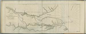
[Chart of Boston Harbor and the surrounding areas]
564.
A chart of the Caribe Islands
565.
A draught of Nelson & Hayes's Rivers latd. 57°. 10'. north, var. 16°. 45'. westerly
566.
France, from the best authorities
567.
A general map of the southern British colonies in America comprehending North and South Carolina, Georgia, East and West...
568.
Ireland, divided into provinces and counties : from the best authorities
569.
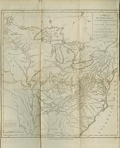
A map of the western part of the territories belonging to the United States of America : drawn from the best authorities
570.
A new & accurate map of North America : drawn from the most authentic modern maps and charts
571.
A New map of North America with the West India Islands : divided according to the preliminary articles of peace, signed at...
572.
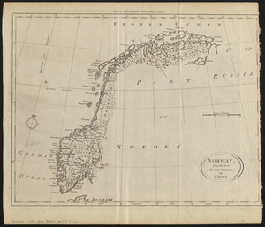
Norway, from the best authorities
573.
A plan of the town of Newport in the province of Rhode Island
574.
The provinces of New York, and New Jersey; with part of Pensilvania, and the governments of Trois Rivieres, and Montreal
575.
The south east coast of Cape Breton Island
576.
Turkey in Europe, from the latest authorities
577.
Map first division railway mail service
578.
Map of the European settlements in North America
579.
A new general chart of the West Indies from the latest marine journals and srveys regulated and ascertained by astronomical...
580.
A new general chart of the West Indies from the latest marine journals and surveys regulated and ascertained by astronomical...
‹ Prev
Next ›
1
2
…
25
26
27
28
29
30
31
32
33
…
113
114
![This plan of the city of Philadelphia and it's [sic] environs, (shewing the improved parts,) is dedicated to the mayor, aldermen and citizens thereof](https://bpldcassets.blob.core.windows.net/derivatives/images/commonwealth:4m90fd11j/image_thumbnail_300.jpg)

![[Chart of Boston Harbor and the surrounding areas]](https://bpldcassets.blob.core.windows.net/derivatives/images/commonwealth:6108vs71d/image_thumbnail_300.jpg)