Toggle navigation
LMEC Home
Exhibitions
Georeferencing
Tools for Teachers
Collections
My Favorites
Sign Up / Log In
Search
Search the map portal
Map Collection
Map Collection
Map Sets
Search
Search
Search for
Search In
All Fields
Creator
Title
Subject
Place
Search All Digital Collections
Advanced Search
44 Results
My Search
Start Over
Date
1949
Remove constraint Date: <span class='single'>1949</span>
Filter your Search
Place
North and Central America
36
United States
35
Massachusetts
9
Boston
7
Suffolk (county)
7
New England
5
Bristol (county)
3
Canada
3
more
Place
»
Topic
Fire risk assessment
14
Insurance surveys
14
Textile factories
7
United States--Maps
5
Woolen and worsted manufacture
4
Factories
3
Immigrants--Massachusetts--Boston
3
New England--Maps--Early works to 1800--Facsimiles
3
more
Topic
»
Date
1949
[remove]
44
Date range begin
–
Date range end
Current results range from
1770
to
1999
1949
to
1949
44
Creator
Associated Factory Mutual Fire Insurance Companies
14
Editions A. Leconte
2
A. M. Walzer Company
1
Bloodgood, Don
1
Boston (Mass.). Department of Parks. Board of Commissioners
1
Bush, M. E.
1
Chase, Ernest Dudley, 1878-
1
Chase, Ernest Dudley, 1878-1966
1
more
Creator
»
Format
Maps/Atlases
41
Photographs
3
Objects/Artifacts
1
Georeferenced
No
44
Collection
Norman B. Leventhal Map & Education Center Collection
29
American Textile History Museum Image Collection
14
Boston and New England Maps
4
Urban Maps
4
American Revolutionary War-Era Maps
1
Applied Geographics, Inc. Records
1
Sidney R. Knafel Map Collection at Phillips Academy
1
Available to use
No known restrictions
29
Search Constraints
Sort by relevance
relevance
title
date (asc)
date (desc)
Number of results to display per page
20 per page
10
per page
20
per page
50
per page
100
per page
View results as:
grid view
map view
Search Results
21.
Map of the Back Bay Fens showing the public ways bordering and crossing them and the neighboring newly laid out parts of...
22.
Map of the island of Tangerina and Wild Island
23.
A map of the West Indies and the Spanish Main
24.
A mapp of New England
25.
Nauset Warehouse (Bldg.), Beacon Manufacturing Company, Tenant, New Bedford, Mass. [insurance map]
26.
New England Theatres, Inc. "Capitol Theatre," New Bedford, Mass. [insurance map]
27.
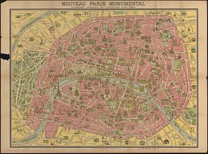
Nouveau Paris monumental : itinéraire pratique de l'etranger dans Paris
28.
The pictorial map, United States stamps
29.
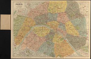
Plan de Paris divisé en 20 arrondissements et 80 quartiers
30.
Plan of corner of Centry & Beacon St's -- 1741
31.
Plan of the burnt district : showing proposed improvements in streets. Nov. 12th 1872
32.
Rollstone Foundry, Inc., Foster Machine Company, Ten., Fitchburg, Mass. [insurance map]
33.
School for newcomers, Temple Kehillath Israel
34.
The Sheffield Corporation, et al., Greenfield, Mass. [insurance map]
35.
Shíjú tú
36.
A small map of the sea coast of New England together with the outlines of several of the provinces lying thereon, 1738
37.
The south part of New-England, as it is planted this yeare, 1635
38.
Storrow Memorial Embankment : plan of additions and changes under the requirements of Chapter 262, Acts of 1949
39.
A Texan's map of the United States [of Texas]
40.
These United States : products & industries
‹ Prev
Next ›
1
2
3


![Nauset Warehouse (Bldg.), Beacon Manufacturing Company, Tenant, New Bedford, Mass. [insurance map]](https://bpldcassets.blob.core.windows.net/derivatives/images/commonwealth:ww72bz70w/image_thumbnail_300.jpg)
![New England Theatres, Inc. "Capitol Theatre," New Bedford, Mass. [insurance map]](https://bpldcassets.blob.core.windows.net/derivatives/images/commonwealth:ww72bz76j/image_thumbnail_300.jpg)


![Rollstone Foundry, Inc., Foster Machine Company, Ten., Fitchburg, Mass. [insurance map]](https://bpldcassets.blob.core.windows.net/derivatives/images/commonwealth:ww72bx841/image_thumbnail_300.jpg)
![The Sheffield Corporation, et al., Greenfield, Mass. [insurance map]](https://bpldcassets.blob.core.windows.net/derivatives/images/commonwealth:ww72bz02r/image_thumbnail_300.jpg)


![A Texan's map of the United States [of Texas]](https://bpldcassets.blob.core.windows.net/derivatives/images/commonwealth:fn107c388/image_thumbnail_300.jpg)
