Toggle navigation
LMEC Home
Exhibitions
Georeferencing
Tools for Teachers
Collections
My Favorites
Sign Up / Log In
Search
Search the map portal
Map Collection
Map Collection
Map Sets
Search
Search
Search for
Search In
All Fields
Creator
Title
Subject
Place
Search All Digital Collections
Advanced Search
80 Results
My Search
Start Over
Date
1806
Remove constraint Date: <span class='single'>1806</span>
Filter your Search
Place
North and Central America
60
United States
50
Massachusetts
11
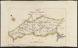
Europe
8
Boston
6
Suffolk (county)
6
New York
4
North Korea
4
more
Place
»
Topic
Boston (Mass.)--Maps
4
Korea--Maps
4
Manuscript maps
4
China--Maps
3
Massachusetts--Maps
3
New Jersey--Maps
3
Seven Years' War, 1756-1763--Campaigns--Poland
3
Anglo-French War, 1778-1783--Naval operations--Maps
2
more
Topic
»
Date
1806
[remove]
80
Date range begin
–
Date range end
Current results range from
1760
to
1990
1806
to
1806
80
Creator
Carey, Mathew, 1760-1839
21
Barker, W. (William), active 1795-1803
13
Doolittle, Amos, 1754-1832
4
Neele, Samuel John, 1758-1824
4
Bingham, William, 1752-1804
2
Seymour, Joseph H.
2
Arrowsmith, Aaron, 1750-1823
1
Barker, Stephen
1
more
Creator
»
Format
Maps/Atlases
80
Manuscripts
19
Georeferenced
Yes
12
No
68
Collection
Norman B. Leventhal Map & Education Center Collection
51
American Revolutionary War-Era Maps
24
Boston and New England Maps
16
Library of Congress Collection
9
Urban Maps
5
MacLean Collection Map Library
4
American Antiquarian Society Collection
2
Library and Archives Canada Collection
2
more
Collection
»
Available to use
No known restrictions
52
Creative Commons license
15
Search Constraints
Sort by relevance
relevance
title
date (asc)
date (desc)
Number of results to display per page
20 per page
10
per page
20
per page
50
per page
100
per page
View results as:
grid view
map view
Search Results
21.
[Isthmus of Tehuantepec, Mexico]
22.
Joseon yojido
23.
Kentuckey
24.
Louisiana
25.
[Manuscript map of coast from Maine to Delaware]
26.
Manuscript maps of U.S. states, possibly drawn by a schoolchild
27.
Map of a part of west-Florida : overlay down
28.
Map of a part of west-Florida : overlay up
29.
Map of Las Ormigas Grant, Sabine and DeSoto Parishes, Louisiana
30.
A map of Massachusetts
31.
Map of Mobile Bay
32.
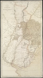
A map of part of the Viceroyalty of Buenos Ayres 1806
33.
[Map of parts of Pennsylvania, New York and New Jersey]
34.
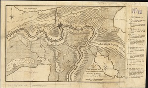
A map of the River Mississippi and territory adjacent to N. Orleans illustrating the military position and camp at Terre au Boeuf
35.
Map of the Southern provinces of the United States
36.
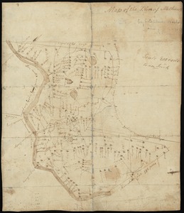
Map of the town of Methuen
37.
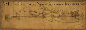
A Map of the Trenton and New-Brunswick Turnpike-road
38.
A map of the Weald of Kent
39.
[Map of W. Dall's lots in Athens County, Washington County, and Gallia County, Ohio]
40.
Maryland
‹ Prev
Next ›
1
2
3
4
![[Isthmus of Tehuantepec, Mexico]](https://bpldcassets.blob.core.windows.net/derivatives/images/commonwealth:4m90fj46g/image_thumbnail_300.jpg)


![[Manuscript map of coast from Maine to Delaware]](https://bpldcassets.blob.core.windows.net/derivatives/images/commonwealth:x633f976h/image_thumbnail_300.jpg)


![[Map of parts of Pennsylvania, New York and New Jersey]](https://bpldcassets.blob.core.windows.net/derivatives/images/commonwealth:6108vt40m/image_thumbnail_300.jpg)

![[Map of W. Dall's lots in Athens County, Washington County, and Gallia County, Ohio]](https://bpldcassets.blob.core.windows.net/derivatives/images/commonwealth:w9505s00n/image_thumbnail_300.jpg)
