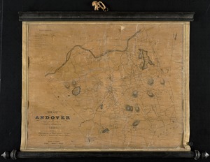
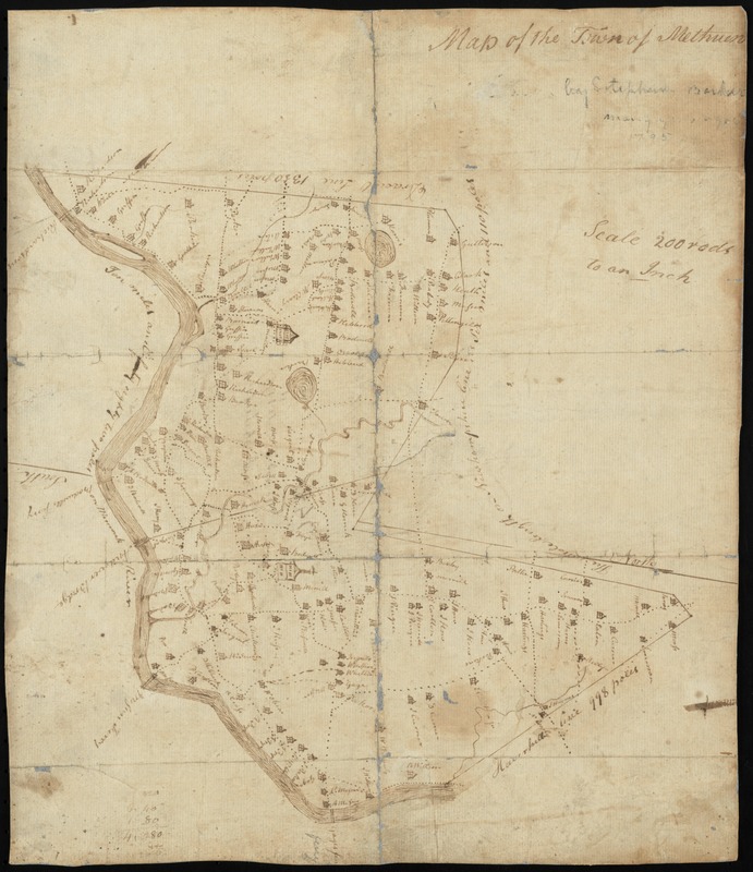
Map of the town of Methuen
Item Information
- Title:
- Map of the town of Methuen
- Title (alt.):
-
Plan of Methuen
- Creator:
- Barker, Stephen
- Name on Item:
-
by Stephen Barker
- Date:
-
[1806?]
- Format:
-
Maps/Atlases
Manuscripts
- Genre:
-
Manuscript maps
- Location:
- Nevins Memorial Library
- Collection (local):
-
Methuen Historic Collection
- Subjects:
-
Real property
Landowners
- Places:
-
Essex (county)Methuen
- Extent:
- manuscript map ; 36 x 31 cm.
- Terms of Use:
-
No known copyright restrictions.
This work is licensed for use under a Creative Commons Attribution Non-Commercial No Derivatives License (CC BY-NC-ND).

- Scale:
-
Scale [1:39,600]. 200 rods to an inch
- Language:
-
English
- Notes:
-
Shows boundaries and landowners.
Oriented with north to the right.
While dated 1795, the map shows the Boston to Concord, N.H. Turnpike, which was built in 1806. Barker likely pre-dated his map to comply with the Massachusetts General Court's order for towns to have maps made by 1795.
Manuscript on verso: Plan of Methuen, 1748, recorded Octr. 1st 1797, book 106, leaf 120 -- Boston, Jany. 20d, 1807.
- Notes (object):
-
Manuscript, pen and ink.
- Identifier:
-
NML_map_01
- Barcode:
-
30000004181667