Toggle navigation
LMEC Home
Exhibitions
Georeferencing
Tools for Teachers
Collections
My Favorites
Sign Up / Log In
Search
Search the map portal
Map Collection
Map Collection
Map Sets
Search
Search
Search for
Search In
All Fields
Creator
Title
Subject
Place
Search All Digital Collections
Advanced Search
38 Results
My Search
Start Over
1933
Remove constraint 1933
Filter your Search
Place
North and Central America
36
United States
34
Massachusetts
6
Boston
5
Suffolk (county)
5
Bristol (county)
4
Oregon
3
Worcester (county)
3
more
Place
»
Topic
Fire risk assessment
9
Insurance surveys
9
Textile factories
7
United States--Maps
4
Thread
3
United States--History--1933-1945--Maps
3
Cape Cod (Mass.)--Maps
2
Consolidated Thread Co. of Mass., Inc.
2
more
Topic
»
Date
Date range begin
–
Date range end
Current results range from
1754
to
1950
View distribution
Creator
Associated Factory Mutual Fire Insurance Companies
6
Geological Survey (U.S.)
3
G.W. Bromley & Co.
2
United States. Forest Service
2
American Map Company (New York, N.Y.)
1
Anderson, Philander, 1810?-1853
1
Appleton, LeRoy H.
1
Arkwright Mutual Insurance Company
1
more
Creator
»
Format
Maps/Atlases
36
Manuscripts
1
Photographs
1
Prints
1
Georeferenced
Yes
2
No
36
Collection
Norman B. Leventhal Map & Education Center Collection
26
American Textile History Museum Image Collection
9
Boston and New England Maps
4
Urban Maps
2
American Revolutionary War-Era Maps
1
British Library Collection
1
Massachusetts Real Estate Atlases
1
Town plans, 1830
1
Available to use
No known restrictions
26
Creative Commons license
2
Search Constraints
Sort by relevance
relevance
title
date (asc)
date (desc)
Number of results to display per page
20 per page
10
per page
20
per page
50
per page
100
per page
View results as:
grid view
map view
Search Results
21.
Santiam National Forest, Oregon
22.
Pend Oreille National Forest, Idaho
23.
A chart of the coast of Maine
24.
A map of Long Island
25.
Mount Hope Bridge, Bristol, Rhode Island
26.
Siskiyou National Forest, Oregon and California
27.
Siuslaw National Forest, Oregon
28.
Tennessee River basin
29.
The topographic map of Manchoukuo
30.
In flight with United Air Lines
31.
Manhattan : first city of America
32.
Atlas of the city of Boston : Dorchester
33.
Atlas of the city of Boston : Dorchester : from actual surveys and official plans
34.
First Load at Copley Plaza
35.
A map of Chicago : incorporated as a town August 5, 1833
36.
A Plan Of the River of Chibenaccadie from its Source To its Discharge into the Bay of Mines Surveyed in August 1754 : The...
37.
Capital Park : Hyde Park ... Boston
38.
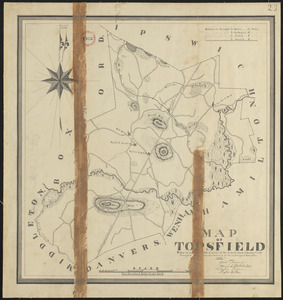
Plan of Topsfield made by Philander Anderson, dated 1830
‹ Prev
Next ›
1
2