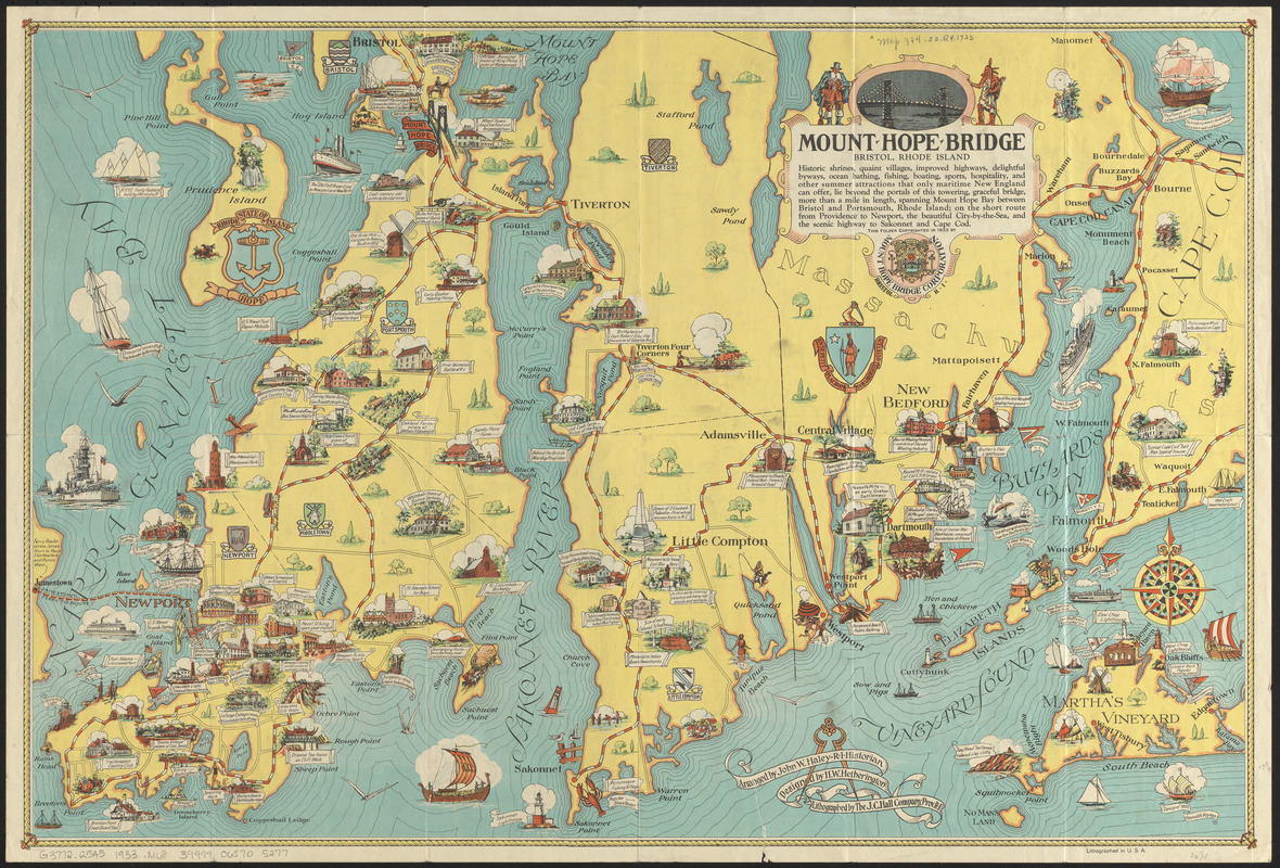
Mount Hope Bridge, Bristol, Rhode Island

Item Information
- Title:
- Mount Hope Bridge, Bristol, Rhode Island
- Title (alt.):
-
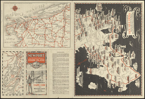
Newport and the historic island of Rhode Island : on the scenic route to Sakonnet, Cape Cod and New England's greatest seashore resorts
- Publisher:
- Mount Hope Bridge Corporation (Bristol, R.I.)
- Contributor:
- Haley, John W.
- Artist:
- Hetherington, Herbert W.
- Lithographer:
- J.C. Hall Company
- Name on Item:
-
arranged by John W. Haley, R.I. historian ; designed by H.W. Hetherington ; lithographed by the J.C. Hall Company
- Date:
-
1933
- Format:
-
Maps/Atlases
- Location:
-
Boston Public Library
Norman B. Leventhal Map & Education Center - Collection (local):
-
Norman B. Leventhal Map & Education Center Collection
- Subjects:
-
Newport (R.I.)--History--Maps
Rhode Island (R.I. : Island)--History--Maps
Newport County (R.I.)--History--Maps
- Places:
-
Rhode IslandNewport (county)Newport
- Extent:
- 4 maps on 1 sheet : both sides, color ; sheet 45 x 67 cm, folded to 23 x 12 cm
- Terms of Use:
-
No known copyright restrictions.
No known restrictions on use.
- Publisher:
-
Bristol, R.I. :
Mount Hope Bridge Corporation
- Scale:
-
Not drawn to scale
- Language:
-
English
- Notes:
-
Includes illustrations of points of interest.
Text and 3 maps on verso.
Maps on verso: Newport's famous ten mile drive along the ocean front -- [Narragansett Bay area] -- [Southern New England].
- Identifier:
-
06_01_014769
06_01_016190
- Call #:
-
G3772.R5A5 1933 .M68
- Barcode:
-
39999065705277


