Toggle navigation
LMEC Home
Exhibitions
Georeferencing
Tools for Teachers
Collections
My Favorites
Sign Up / Log In
Search
Search the map portal
Map Collection
Map Collection
Map Sets
Search
Search
Search for
Search In
All Fields
Creator
Title
Subject
Place
Search All Digital Collections
Advanced Search
247 Results
My Search
Start Over
Date
1905
to
1909
Remove constraint Date: <span class='from'>1905</span> to <span class='to'>1909</span>
Filter your Search
Place
North and Central America
196
United States
178
Massachusetts
77
Suffolk (county)
35
Boston
34
Essex (county)
15
Canada
14
Norfolk (county)
14
more
Place
»
Topic
Boston (Mass.)--Maps
17
Massachusetts--Maps
9
United States--Maps
9
Gold mines and mining--Nova Scotia--Maps
8
Real property--Massachusetts--Boston--Maps
8
Landowners--Massachusetts--Boston--Maps
7
Fire risk assessment
6
Insurance surveys
6
more
Topic
»
Date
1905
to
1909
[remove]
247
Date range begin
–
Date range end
Current results range from
1770
to
1999
1905
to
1905
87
1906
to
1906
86
1907
to
1907
73
1908
to
1908
71
1909
to
1909
69
Creator
Fisk, E. F.
14
Walker Lith. & Pub. Co
13
International Correspondence Schools
12
International Textbook Company
12
Geo. H. Walker & Co.
10
Bromley, George Washington
9
Bromley, Walter Scott
9
Geological Survey of Canada
9
more
Creator
»
Format
Maps/Atlases
243
Photographs
3
Prints
2
Books
1
Manuscripts
1
Objects/Artifacts
1
Georeferenced
Yes
31
No
216
Collection
Norman B. Leventhal Map & Education Center Collection
220
Boston and New England Maps
33
Urban Maps
22
Massachusetts Real Estate Atlases
15
American Textile History Museum Image Collection
6
Maritime Charts and Atlases
6
Mapping Boston Collection
4
Robert E. Diefenbach Map Collection at Phillips Academy
4
more
Collection
»
Available to use
No known restrictions
221
Creative Commons license
4
Search Constraints
Sort by relevance
relevance
title
date (asc)
date (desc)
Number of results to display per page
20 per page
10
per page
20
per page
50
per page
100
per page
View results as:
grid view
map view
Search Results
201.
Plan of the town of Boston
202.
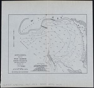
Plan of Wild Harbor at North Falmouth : under chapter 112 resolves of 1907
203.
Plano de Asuncion
204.
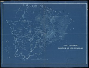
Plano topografico del canton de Los Tuxtlas
205.
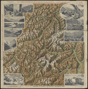
Plastische karte von Landeck, Tirol : ins ortlergebiet Kaunsertaler u. Oetztaleralpen, Silvretta u. Verwaligruppe...
206.
Port of Manchester
207.
Preliminary geological map of Connecticut
208.
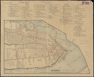
Quebec
209.
Railroad Commissioners' map of the State of Vermont
210.
Rand, McNally & Co.'s Arizona
211.
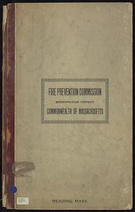
Reading, Middlesex County, Massachusetts
212.
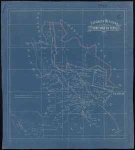
República Mexicana, Territorio de Tepic
213.
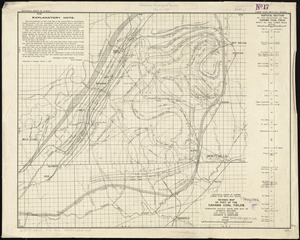
Revised map of part of the Cahaba coal fields
214.
Rock Island-Frisco lines and Chicago & Eastern Illinois R.R : traverse the richest and most prosperous commonwealths in the Union
215.
Roma, suburbio e dintorni
216.
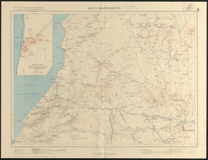
Safi-Marrakech
217.
Samuel Thaxter & Son, manufacturers and importers of nautical and optical instruments, charts and nautical books; publishers of...
218.
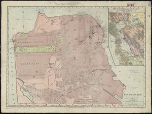
San Francisco
219.
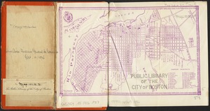
Sketch map of Boston and the Public Library system
220.
A small map of the sea coast of New England together with the outlines of several of the provinces lying thereon, 1738
‹ Prev
Next ›
1
2
…
7
8
9
10
11
12
13