Port of Manchester
Item Information
- Title:
- Port of Manchester
- Title (alt.):
-
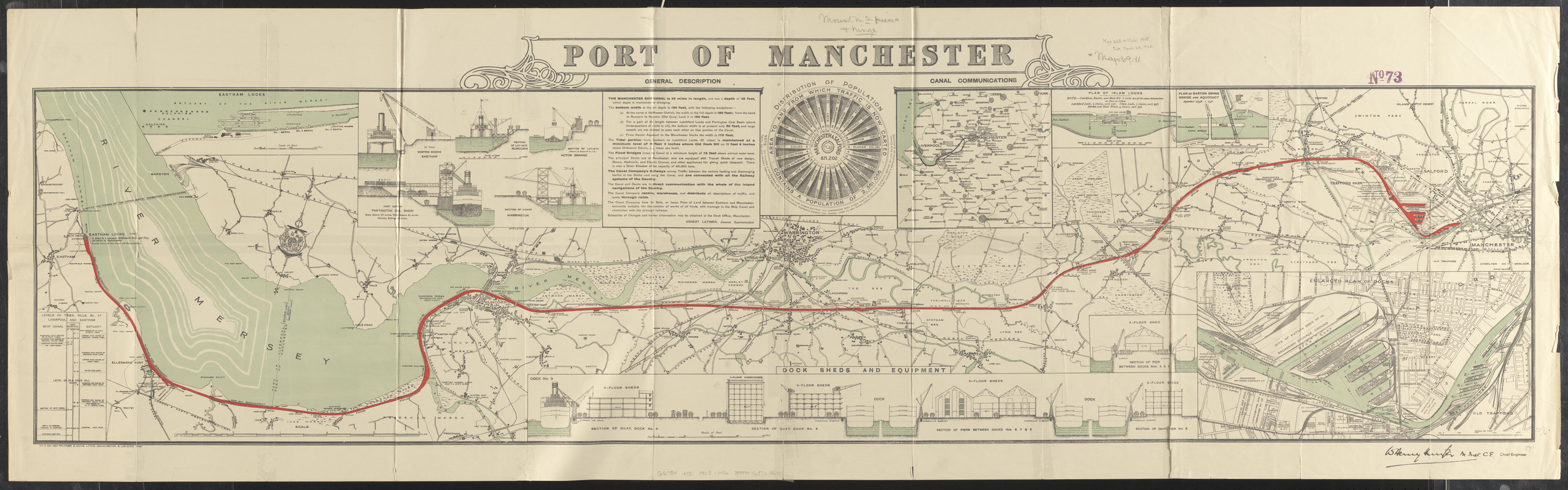
Port of Manchester : plan of the Manchester Ship Canal
Plan of the Manchester Ship Canal
- Cartographer:
- Hunter, W. Henry
- Lithographer:
- George Falkner and Sons
- Publisher:
- Manchester Ship Canal Co.
- Name on Item:
-
W. Henry Hunter, M. Inst., C.E., chief engineer
- Date:
-
1908
- Format:
-
Maps/Atlases
- Location:
-
Boston Public Library
Norman B. Leventhal Map & Education Center - Collection (local):
-
Norman B. Leventhal Map & Education Center Collection
- Subjects:
-
Docks--England--Manchester--Pictorial works
Manchester Ship Canal (England)--Maps
- Places:
-
EnglandManchester, City and Borough of (county)Manchester
EnglandManchester Ship Canal
- Extent:
- 1 map : color ; 35 x 147 cm, folded to 23 x 13 cm
- Terms of Use:
-
No known copyright restrictions.
No known restrictions on use.
- Publisher:
-
[Manchester] :
[Manchester Ship Canal Company]
- Scale:
-
Scale approximately 1:35,000
- Language:
-
English
- Notes:
-
Oriented with north towards the upper right.
Includes general description, distribution of population, 5 inset maps, diagram of levels of tides, sills, &c at Liverpool and Eastham and illustrations of dock sheds and equipment
Inset maps: Eastham locks -- Canal communications -- Plan of Irlam locks -- Plan of Barton swing bridge and aqueduct -- Enlarged plan of docks.
Cartographer's name signed in lower right.
- Identifier:
-
06_01_015021
- Call #:
-
G5754.M31 1908 .H86
- Barcode:
-
39999065708214


