Toggle navigation
LMEC Home
Exhibitions
Georeferencing
Tools for Teachers
Collections
My Favorites
Sign Up / Log In
Search
Search the map portal
Map Collection
Map Collection
Map Sets
Search
Search
Search for
Search In
All Fields
Creator
Title
Subject
Place
Search All Digital Collections
Advanced Search
297 Results
My Search
Start Over
1780
Remove constraint 1780
Filter your Search
Place
North and Central America
259
United States
180
Canada
40
New York
34
Charleston (county)
31
Charleston
27
South Carolina
25
New Jersey
19
more
Place
»
Topic
United States--History--Revolution, 1775-1783--Maps
54
Manuscript maps--Early works to 1800
22
Charleston (S.C.)--Maps
11
Charleston (S.C.)--Siege, 1780--Maps
9
Fortification--Newfoundland and Labrador--St. John's--Maps, Manuscript--Early works to 1800
9
Harbors--Newfoundland and Labrador--St. John's--Maps, Manuscript--Early works to 1800
9
Military art and science--Newfoundland and Labrador--St. John's--Maps, Manuscript--Early works to 1800
9
St. John's (N.L.)--Maps, Manuscript--Early works to 1800
9
more
Topic
»
Date
Date range begin
–
Date range end
Current results range from
1711
to
1909
View distribution
Creator
Skinner, Monier
28
Skinner, William, 1700-1780
28
Des Barres, Joseph F. W. (Joseph Frederick Wallet), 1722-1824
25
Faden, William, 1749-1836
16
André, John, 1751-1780
11
Bonne, Rigobert, 1727-1794
8
Carver, Jonathan, 1710-1780
6
Ferguson, Patrick, 1744-1780
6
more
Creator
»
Format
Maps/Atlases
291
Manuscripts
71
Prints
5
Drawings/Illustrations
1
Georeferenced
Yes
7
No
290
Collection
American Revolutionary War-Era Maps
266
Norman B. Leventhal Map & Education Center Collection
66
William L. Clements Library Collection
65
Library of Congress Collection
63
British Library Collection
33
Maritime Charts and Atlases
27
Richard H. Brown Revolutionary War Map Collection at Mount Vernon
26
Boston and New England Maps
13
more
Collection
»
Available to use
Creative Commons license
142
No known restrictions
66
Search Constraints
Sort by relevance
relevance
title
date (asc)
date (desc)
Number of results to display per page
20 per page
10
per page
20
per page
50
per page
100
per page
View results as:
grid view
map view
Search Results
201.
Castle William : A view of New Castle with the Fort and light house on the entrance of the Pisquataqua River
202.
A chart of Nova Scotia
203.
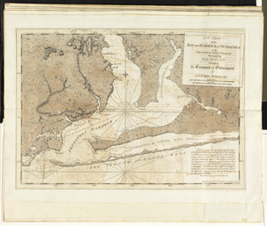
A chart of the bay and harbour of Pensacola in the Province of West Florida
204.
A chart of the British Channel and the Bay of Biscay, with a part of the North Sea, and the entrance of St. George's Channel
205.
A chart of the coast of New York, New Jersey, Pensilvania, Maryland, Virginia, North Carolina, &c
206.
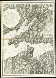
A chorographical map of the northern department of North-America
207.
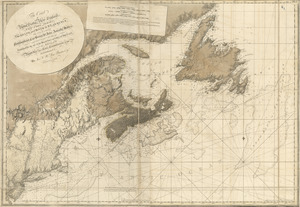
The coast of Nova Scotia, New England, New-York, Jersey, the Gulph and River of St. Lawrence : the islands of Newfoundland,...
208.
Connecticut and parts adjacent
209.
Hafen von Boston
210.
Les Isles Antilles et le Golfe du Méxique
211.
The isthmus of Nova Scotia
212.
Map of coast from southern Florida to central New Jersey
213.
A map of South Carolina and a part of Georgia : Containing the whole sea-coast; all the islands, inlets, rivers, creeks,...
214.
A map of the country in which the army under Lt. General Burgoyne acted in the campaign of 1777 : shewing the marches of the...
215.
A map of the country in which the army under Lt. General Burgoyne acted in the campaign of 1777 : shewing the marches of the...
216.
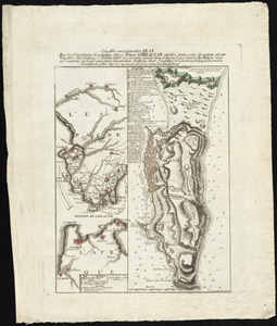
Neuester und acurater plan der weltberuhmten Englischen berg festung Gibraltar auf der Spitze von Spanien : derer wercher...
217.
A New and accurate map of Virginia : and part of Maryland and Pennsylvania
218.
North America
219.
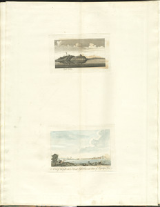
The north point of Grandmanan Island in the bay Fundy bearing e.n.e distant two leagues ; A view of Campo Bello at the entrance...
220.
The north point of Grandmanan Island in the bay Fundy bearing e.n.e distant two leagues ; A view of Campo Bello at the entrance...
‹ Prev
Next ›
1
2
…
7
8
9
10
11
12
13
14
15