Toggle navigation
LMEC Home
Exhibitions
Georeferencing
Tools for Teachers
Collections
My Favorites
Sign Up / Log In
Search
Search the map portal
Map Collection
Map Collection
Map Sets
Search
Search
Search for
Search In
All Fields
Creator
Title
Subject
Place
Search All Digital Collections
Advanced Search
1227 Results
My Search
Start Over
More Like
commonwealth-oai:xk81pj70h
Remove constraint More Like: commonwealth-oai:xk81pj70h
Filter your Search
Place
North and Central America
1,192
United States
933
Canada
226
New York
193
Quebec
111
Pennsylvania
61
New Jersey
54
Nova Scotia
48
more
Place
»
Topic
United States--Maps
330
United States--History--Revolution, 1775-1783--Maps
305
United States--History--French and Indian War, 1754-1763--Maps
151
Saint Lawrence River--Maps
44
Elections--United States--Maps
36
Railroads--United States--Maps
34
Canada--Maps
29
Newport (R.I.)--Maps
27
more
Topic
»
Date
Date range begin
–
Date range end
Current results range from
1700
to
2023
View distribution
Creator
Paullin, Charles Oscar, 1868 or 1869-1944
70
Wright, John Kirtland, 1891-1969
70
Rocque, Mary Ann
29
Bellin, Jacques Nicolas, 1703-1772
26
Holland, Samuel, 1728-1801
25
Montrésor, John, 1736-1799
25
Jefferys, Thomas, -1771
24
Clinton, Henry, Sir, 1738?-1795
19
more
Creator
»
Format
Maps/Atlases
1,209
Drawings/Illustrations
11
Documents
5
Prints
3
Books
1
Manuscripts
1
Objects/Artifacts
1
Posters
1
Georeferenced
Yes
65
No
1,162
Collection
American Revolutionary War-Era Maps
939
William L. Clements Library Collection
909
Norman B. Leventhal Map & Education Center Collection
288
American Antiquarian Society Collection
20
MacLean Collection Map Library
9
David Judkins Weaver Papers
2
Mapping Boston Collection
2
Applied Geographics, Inc. Records
1
more
Collection
»
Available to use
No known restrictions
213
Creative Commons license
5
Search Constraints
Sort by relevance
relevance
title
date (asc)
date (desc)
Number of results to display per page
20 per page
10
per page
20
per page
50
per page
100
per page
View results as:
grid view
map view
Search Results
601.
Map of Putnam
602.
A map of that part of Pensylvania now the principle seat of war in America wherein may be seen the situation of Philadelphia,...
603.
Map of the area between Fort Loudon, Tennessee, and Kaskaskia, Illinois
604.
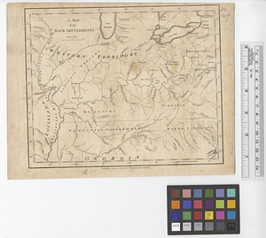
A map of the back settlements
605.
A map of the British and French settlements in North America
606.
Map of the British landings at Louisbourg
607.
Map of the coast of Cape Breton from Fort William to Louisbourg
608.
Map of the coast of Hunduras [sic] from the bay of Truxillo to the river Dulcee also the interieur part of that country, from...
609.
A map of the colony of Rhode Island : with the adjacent parts of Connecticut, Massachusetts Bay, &c.
610.
Map of the country adjacent to Fort [Franklin] on French Creek
611.
A map of the country adjacent to Kingsbridge, surveyed by order of his excellency General Sir Henry Clinton K.B., commander in...
612.
A map of the country between Will's Creek & Monongahela River shewing the rout and encampments of the English army, in 1755
613.
A map of the Delaware and Chesapeak bays with the peninsula between them
614.
A map of the environs of Boston
615.
A map of the environs of Brooklyn : surveyed by order of his excellency General Sir Henry Clinton K.B., commander in chief of...
616.
A map of the farm and a draught of the buildings thereon, in West-town Township, Chester Co. Pennsylvania, belonging to the...
617.
A map of the farm of Wm. Wilson esqr. in Clermont ... : surveyed May 3d, 1799
618.
A map of the five Great Lakes with part of Pensilvania, New York, Canada and Hudsons Bay territories &c.
619.
A map of the Indian nations in the southern department, 1766
620.
A map of the island of Cape Breton
‹ Prev
Next ›
1
2
…
27
28
29
30
31
32
33
34
35
…
61
62


![Map of the coast of Hunduras [sic] from the bay of Truxillo to the river Dulcee also the interieur part of that country, from the mouth of the river Roman to the city of Comayagua and their principle mines](https://bpldcassets.blob.core.windows.net/derivatives/metadata/commonwealth-oai:rj434386k/image_thumbnail_300.jpg)

![Map of the country adjacent to Fort [Franklin] on French Creek](https://bpldcassets.blob.core.windows.net/derivatives/metadata/commonwealth-oai:2v240r691/image_thumbnail_300.jpg)