Toggle navigation
LMEC Home
Exhibitions
Georeferencing
Tools for Teachers
Collections
My Favorites
Sign Up / Log In
Search
Search the map portal
Map Collection
Map Collection
Map Sets
Search
Search
Search for
Search In
All Fields
Creator
Title
Subject
Place
Search All Digital Collections
Advanced Search
952 Results
My Search
Start Over
More Like
commonwealth-oai:xg94nq67c
Remove constraint More Like: commonwealth-oai:xg94nq67c
Filter your Search
Place
North and Central America
912
United States
637
Canada
220
New York
193
Quebec
114
Saint Lawrence River
66
Pennsylvania
60
New Jersey
54
more
Place
»
Topic
United States--History--Revolution, 1775-1783--Maps
305
United States--History--French and Indian War, 1754-1763--Maps
162
Saint Lawrence River--Maps
67
Newport (R.I.)--Maps
27
Québec (Québec)--Maps
27
New York (State)--Maps
25
Hudson River (N.Y. and N.J.)--Maps
21
Louisbourg (N.S.)--Maps
20
more
Topic
»
Date
Date range begin
–
Date range end
Current results range from
1700
to
1900
View distribution
Creator
Jefferys, Thomas, -1771
30
Holland, Samuel, 1728-1801
29
Montrésor, John, 1736-1799
29
Rocque, Mary Ann
29
Bellin, Jacques Nicolas, 1703-1772
28
Clinton, Henry, Sir, 1738?-1795
19
Robert Sayer and John Bennett (Firm)
16
Orme, Robert, -1781
14
more
Creator
»
Format
Maps/Atlases
936
Drawings/Illustrations
11
Documents
5
Manuscripts
1
Prints
1
Georeferenced
No
952
Collection
American Revolutionary War-Era Maps
947
William L. Clements Library Collection
909
Library and Archives Canada Collection
18
Norman B. Leventhal Map & Education Center Collection
9
American Antiquarian Society Collection
5
Richard H. Brown Revolutionary War Map Collection at Mount Vernon
4
MacLean Collection Map Library
3
New York Public Library Collection
3
more
Collection
»
Available to use
No known restrictions
10
Creative Commons license
7
Search Constraints
Sort by relevance
relevance
title
date (asc)
date (desc)
Number of results to display per page
20 per page
10
per page
20
per page
50
per page
100
per page
View results as:
grid view
map view
Search Results
461.
A map of the farm and a draught of the buildings thereon, in West-town Township, Chester Co. Pennsylvania, belonging to the...
462.
A map of the farm of Wm. Wilson esqr. in Clermont ... : surveyed May 3d, 1799
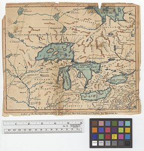
463.
A map of the five Great Lakes with part of Pensilvania, New York, Canada and Hudsons Bay territories &c.
464.
A map of the French settlements in North America
465.
A map of the Indian nations in the southern department, 1766
466.
A map of the isthmus of Panama drawn from Spanish surveys
467.
A map of the lakes & Hudsons Bay
468.
A map of the lakes & Hudsons Bay
469.
Map of the middle states of America : comprehends New-York, New-Jersey, Pennsylvania, Delaware, and the territory N:W: of Ohio
470.
Map of the middle states of America : comprehends New-York, New-Jersey, Pennsylvania, Delaware, and the territory N:W: of Ohio
471.
A map of the north west parts of the United States of America
472.
A map of the North Western Territory
473.
A map of the northern and middle states; comprehending the western territory and the British dominions in North America from...
474.
Map of the northern part of the United States of America
475.
A map of the pass at Jamaica, Long Island : surveyed by order of his excellency General Sir Henry Clinton K:B: commander in...
476.
Map of the powers at war with Great Britain, 1783
477.
A map of the province of Massachusetts Bay, and colony of Rhode Island, with part of Connecticut, New Hampshire, and Vermont
478.
A map of the sea coast of Georgia & the inland parts thereof extending to the westward of that part of Savannah called Broad...
479.
Map of the Second Nine Partners Tract in Dutchess County, protracted by a scale of one hundred chains to an inch
480.
A map of the United States
‹ Prev
Next ›
1
2
…
20
21
22
23
24
25
26
27
28
…
47
48